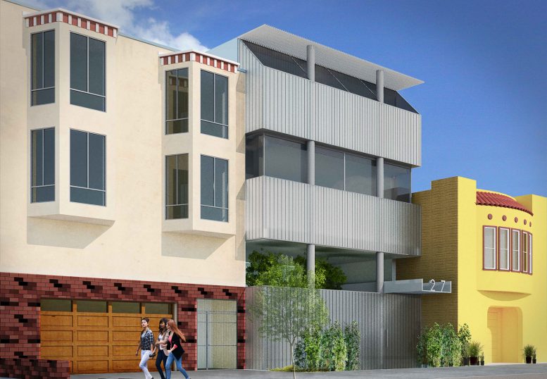
New renderings have been revealed for a new single-family residence at 1271 46th Avenue in the Sunset District of San Francisco. The project will replace an existing single-family cottage with a Metabolist design, including an interior garden, terrace, two roof decks, and an elevated fourth-floor living room. Natoma Architects is responsible for the design.
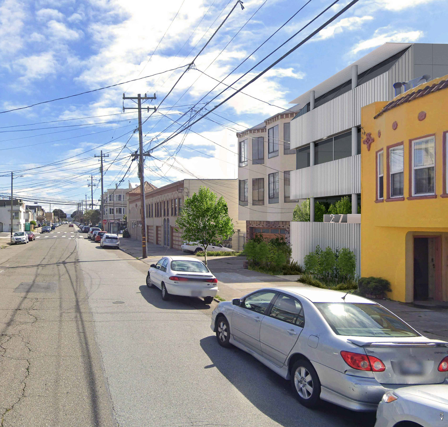
1271 46th Avenue side view, rendering by Stanley Saitowitz Architects
Natoma Architects is led by the American architect Stanley Saitowitz. The firm has an extensive portfolio across the city with innovative and daring designs. In the firm’s proposal for 1271 46th Avenue, the building is clad with vertical planks of transparent Bendheim glass system with aluminum backing. Twelve-inch tall aluminum letters will be used to show the street address.
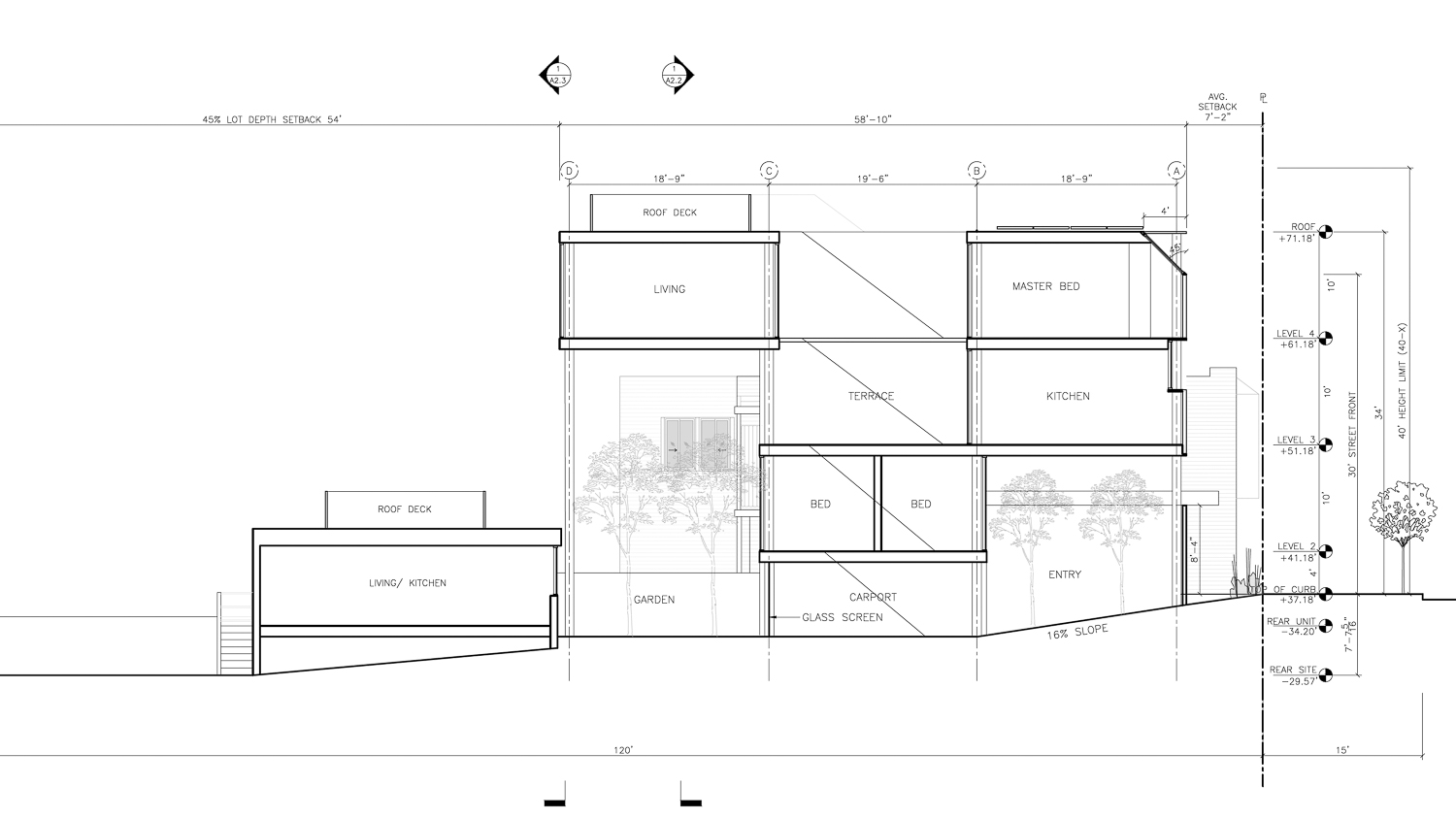
1271 46th Avenue vertical elevation, drawing by Stanley Saitowitz Architects
The 34-foot tall structure will yield 3,130 square feet. Parking is included on-site for two vehicles.
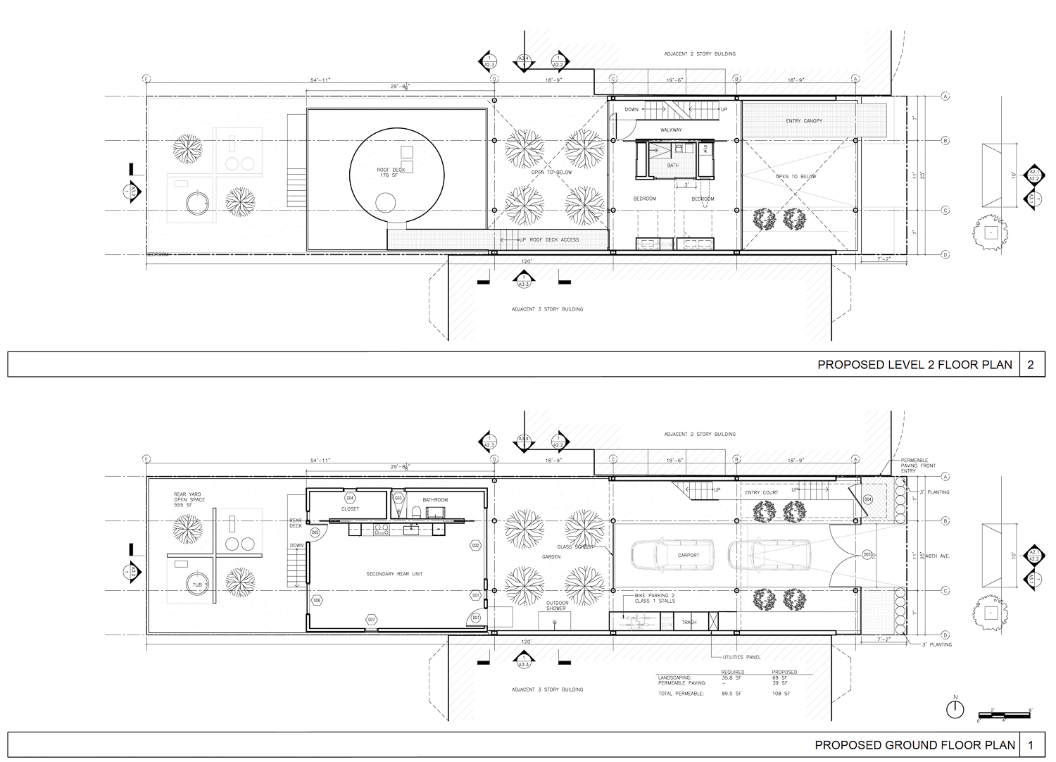
1271 46th Avenue proposed ground floor and second floor, rendering by Stanley Saitowitz Architects
The parcel is located on a wide residential lane, fitted between Irving Street and Golden Gate Park. Ocean Beach is four blocks away on foot. An estimated completion date has not been announced. Partricia Buse is listed as the property owner.
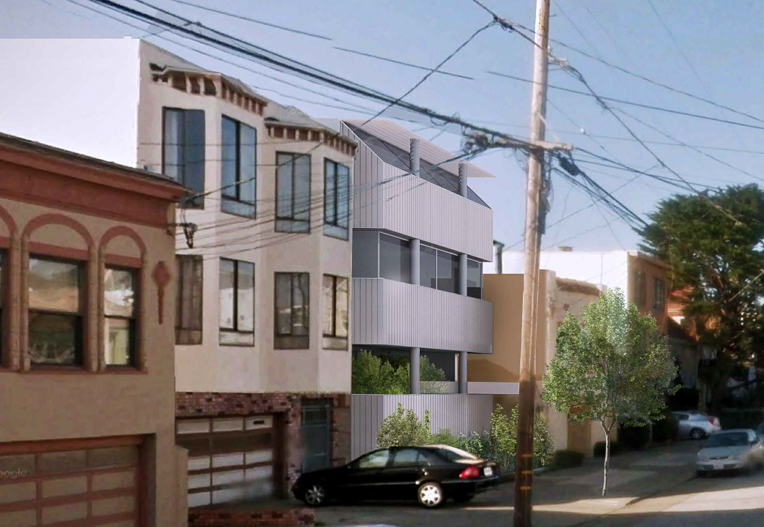
1271 46th Avenue from 46th Ave, rendering by Stanley Saitowitz Architects
Correction: An earlier version of this article misleadingly described the proposed roof height for 1271 46th Avenue from sea level, which measures 71 feet high. The structure’s height from street level measures 34 feet high.
Subscribe to YIMBY’s daily e-mail
Follow YIMBYgram for real-time photo updates
Like YIMBY on Facebook
Follow YIMBY’s Twitter for the latest in YIMBYnews





That floor plan is wild. Definitely a house for people who like the outdoors. Very extravagant. A hot tub for each unit! Little bit far into the fog belt, but who am I to judge?
But man is the facade ugly. No idea what anyone sees in that guy’s designs.
Also, “71-foot tall structure”? I love the projects that you highlight, but does no one proofread here?
Ok, that was harsh– I see where you got 71 feet from (the rear of the yard is 30 feet below the street) but it’s still not a 71-foot structure.
Last comment, I promise: the roof is 34 feet above the street, and the rear yard is 7.5 feet below, and there are some errors in pluses and minuses in the drawings. And they’re labeling elevation from sea level, or something, because street level is at 37 feet.
Thank you so much for calling that out! You are right, that was a glaring mistake which commonsense should have alerted me was wrong, and that confusion about sea level being factored into the planning document was indeed the source of the mistake.