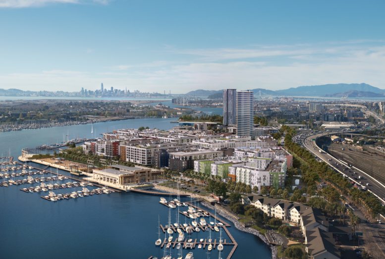
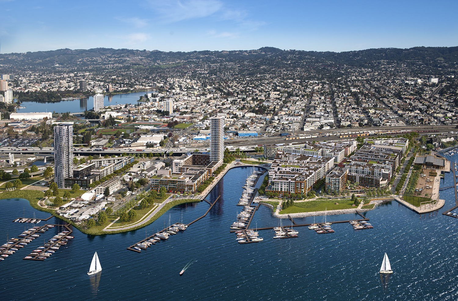
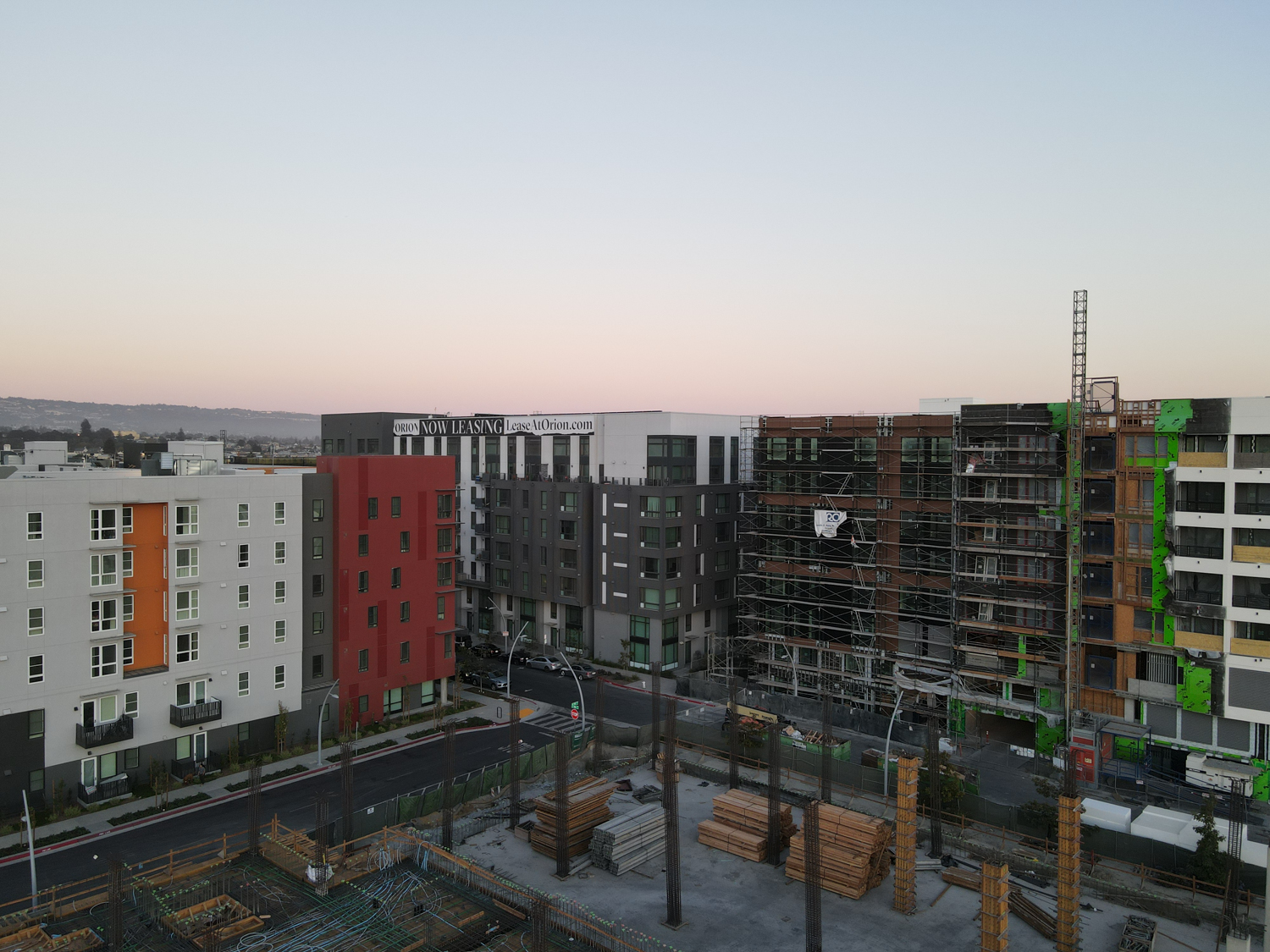
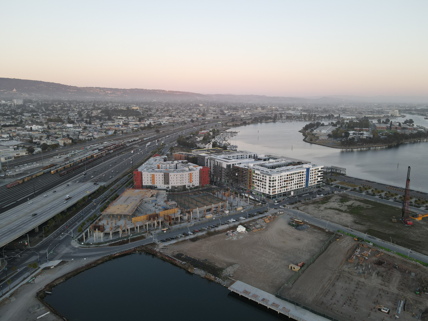
New aerial photographs show significant progress since April of this year for Brooklyn Basin, a mixed-use development reshaping a former industrial section of the Oakland waterfront. Six apartment building sites are in stages of development, varying from foundational work starting to residents already moved in. Oakland-based Signature Development Group is developing the project, with joint financing from Signature, Zarsion Holdings Group, and Reynolds & Brown.
Brooklyn Basin phase one site, aerial image
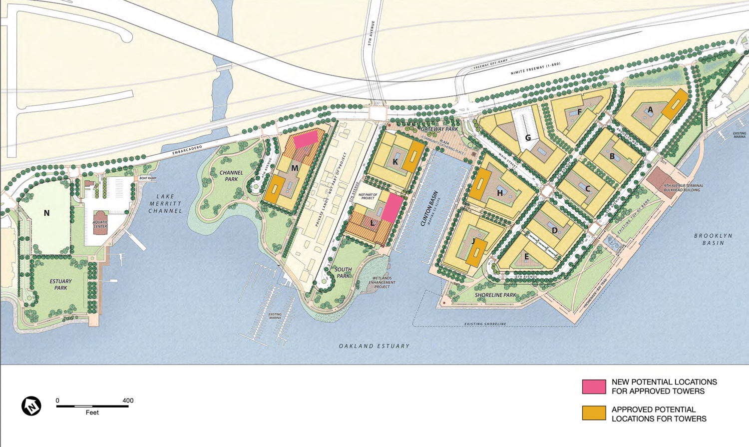
Brooklyn Basin new site map, image via planning documents
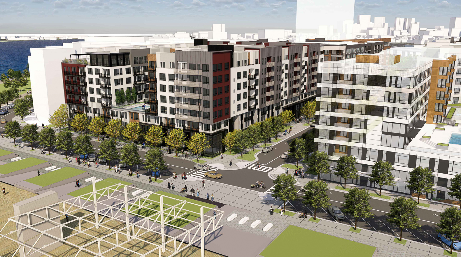
Brooklyn Basin with Oakland skyline, rendering courtesy EK
The development is expected to create thousands of dwelling units, roughly 200,000 square feet of retail, new marina slips, and acres of public parks. A recent planning commission meeting also reviewed plans to increase residential capacity by 600 apartments, bringing the expected total at build-out to 3,700 residences. The marina capacity will also be nearly doubled to 325 slips, with improvements to accommodate a water taxi or shuttle service. Parking capacity will be included for 3,625 vehicles, an increase from 3,534. Affordable housing will be included on-site, with management by MidPen Housing.
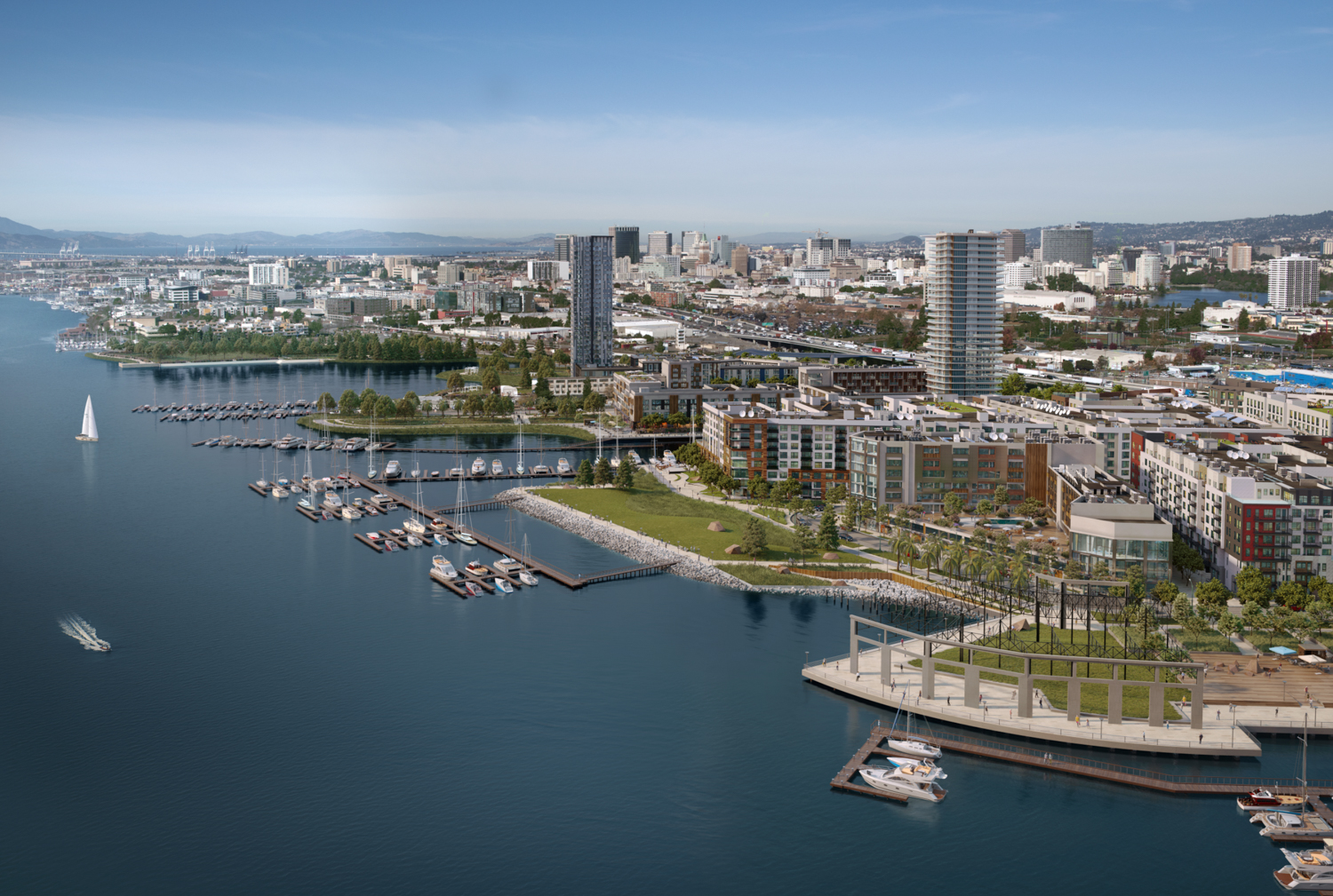
Brooklyn Basin with Lake Merritt in the background, rendering courtesy EK
Along with expanded unit and maria count, the modifications bring up the suggestion of moving the location of one of five eventual 24-story towers. As written in the planning documents, Signature is considering moving “one of the approved tower designations from either Parcel H or J to either Parcel L or M.” This could lead to two towers rising from Parcel M and increased building mass in phase three or four to absorb the addition of 600 units.
Brooklyn Basin Parcel C, aerial image
Brooklyn Basin Parcel G construction update, aerial image
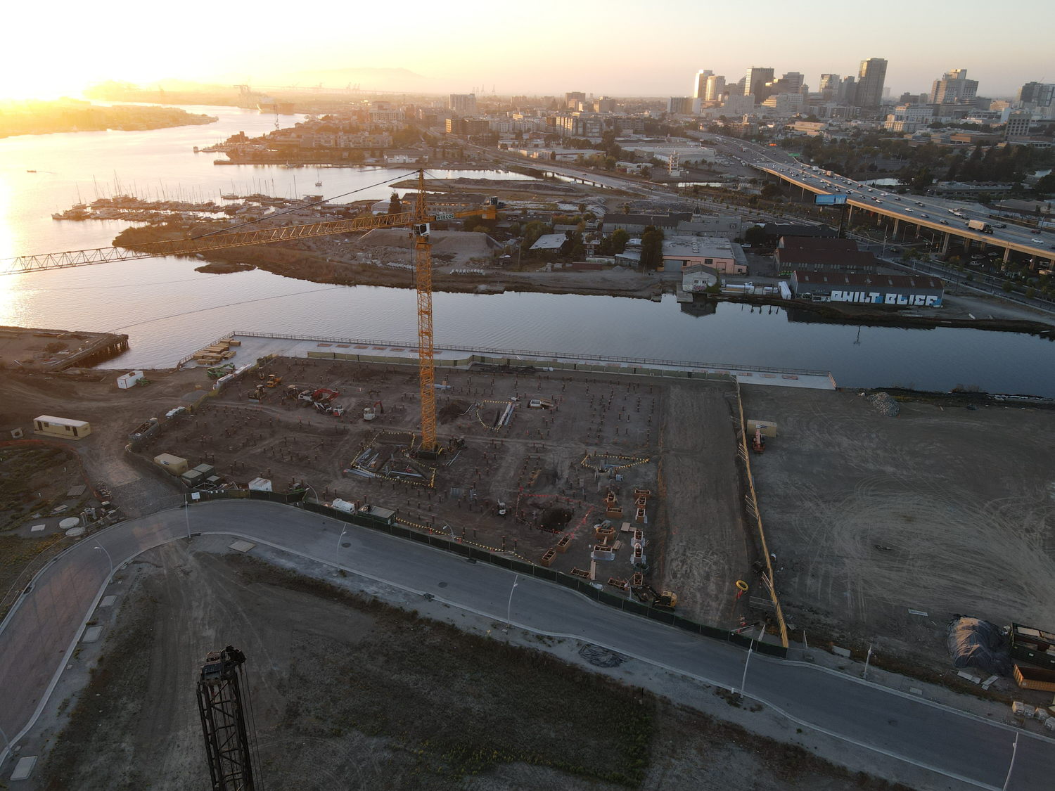
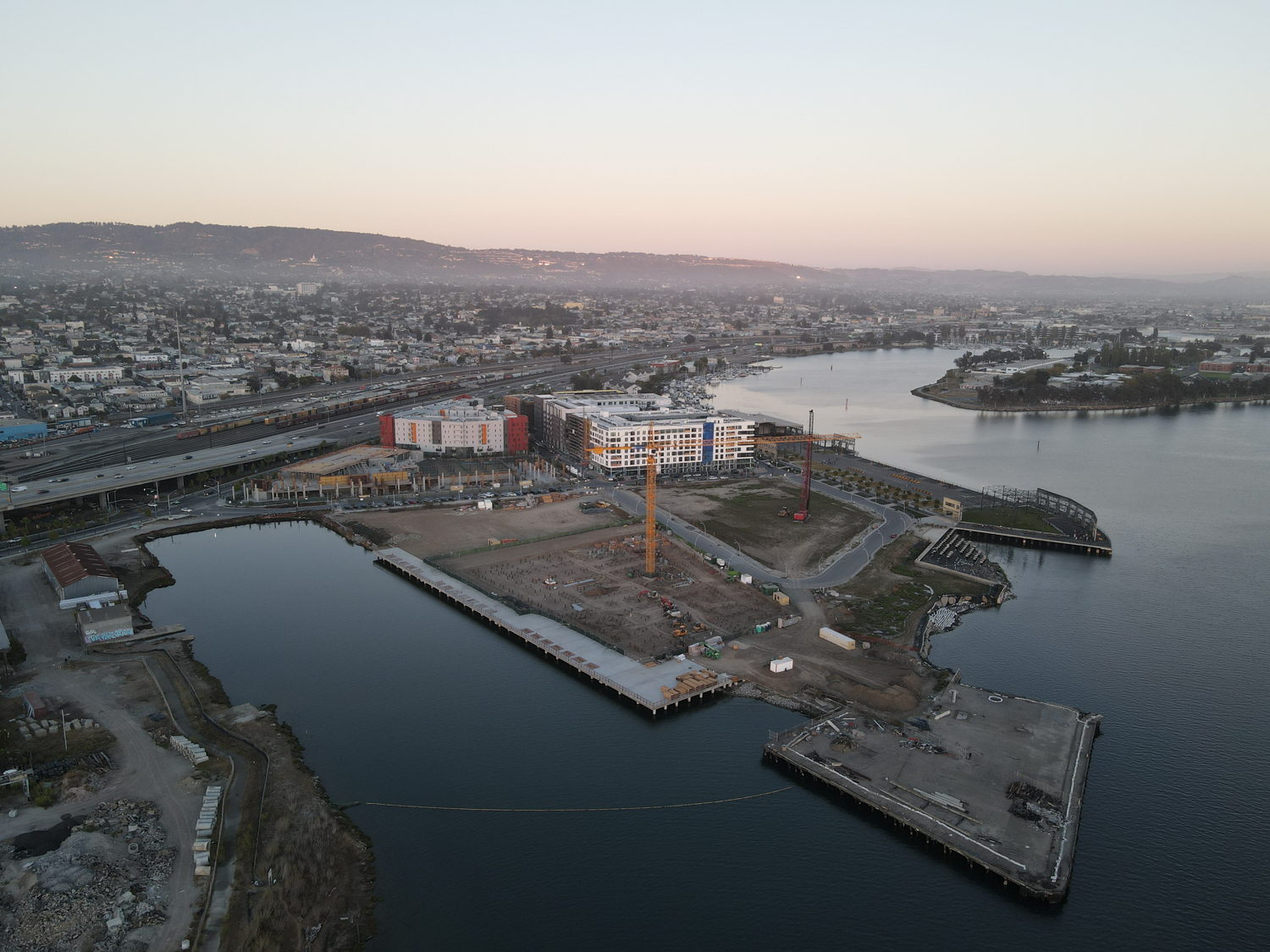
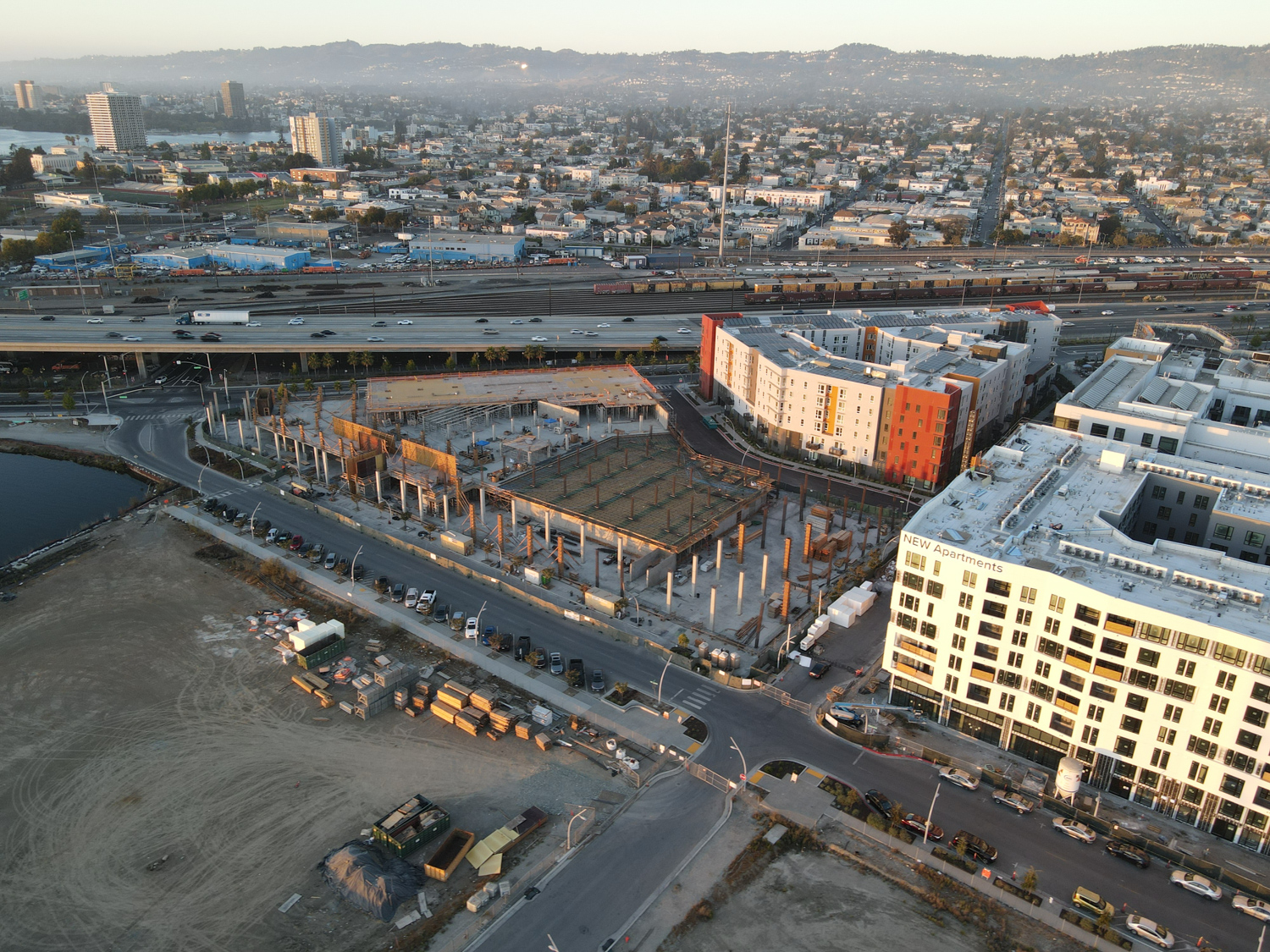
Brooklyn Basin Parcel J foundation work underway, aerial image
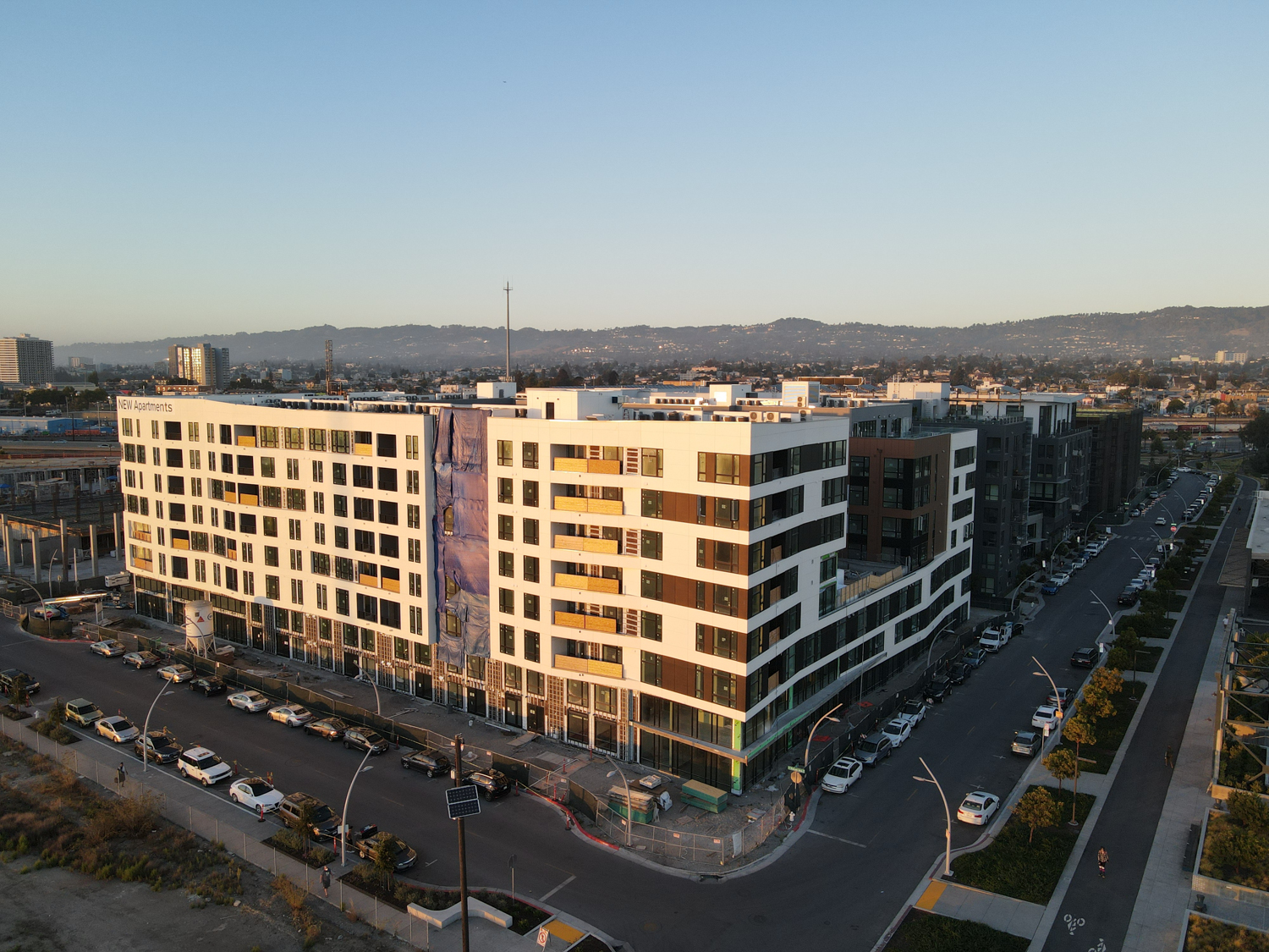
Brooklyn Basin, Parcels F, B, and C from left to right, aerial image
Brooklyn Basin, aerial image
Development has finished for Parcel B and F. Parcel C has topped out with facade installation nearly complete, showcasing the design by Studio T Square. HKIT Architects’ Parcel A is nearing its top floor. Concrete is rising above street level now for Parcel G, designed by TCA Architects. Most recently, activity is underway for the foundation of Parcel J designed by TSM Architects and developed by Cityview, and an accompanying waterfront deck.
Brooklyn Basin Parcel C rendering, image courtesy Brooklyn Basin website
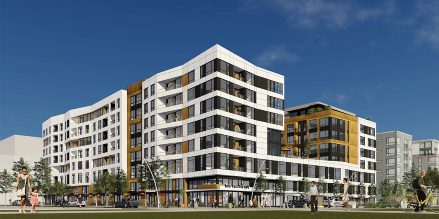
Brooklyn Basin Parcel D at One Ninth Avenue across from the Shoreline Park, rendering of design by Architecture Design Collaborative
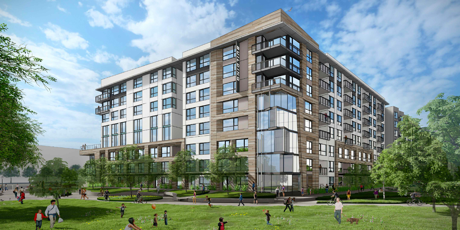
Parcel J at 37 8th Avenue in Brooklyn Basin view from public park, design by TSM Architects
Full build-out is expected by 2027.
Subscribe to YIMBY’s daily e-mail
![]()
Follow YIMBYgram for real-time photo updates
Like YIMBY on Facebook
Follow YIMBY’s Twitter for the latest in YIMBYnews
So… it is very visible now, that the “homeless problem” has been pushed SOUTH. Once you pass Brooklyn Basin, the problem becomes worse to severe. I seems that the effort to remove the “Blythe and unsightly” stops at Embarcadero South. It is obvious that the city of Oakland is trying to project an image to the world, but the “CAMERAS” stop just South of this Billion Dollar Project. The situation from the 4 waterfront hotels is the worst it has ever been. Crime is the highest it has ever been. “Homeless encampments” on both sides of the 880 freeway.People that work in this area are scared to go to work or park their cars on the street. It seems there is plenty of money from Jack London to Brooklyn Basin and then the “Budget” stops. All the efforts to “beautify” this zone has made ghettos of ares South of Brooklyn Basin. People that use our business have pointed this out to us. “Ghetto and dangerous” are common descriptions used about Embarcadero South. Pathetic efforts by the City of Oakland.All the beautiful photos and renderings of Brooklyn Basin, do not show the real truth just blocks away. I am certain that The City of Oakland will do all that is possible to protect this NEW Waterfront from ever becoming, what exist, just South of it. It is obvious where the $MONEY$ runs-out.
Soooo very sad but tru, mr christensen. Pathetic. What is the issue with behaving n a humane fashion and addressing the homeless encampments and all they entail! 🤦🏾♀️🤬👎🏽 so not cool.