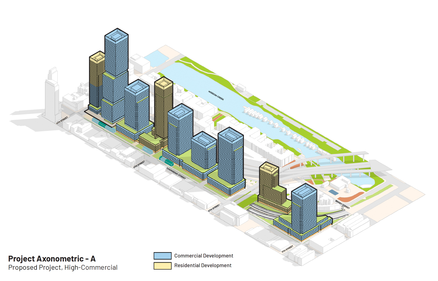
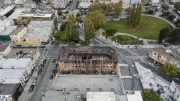
Preliminary plans have been submitted for the potential redevelopment of the Caltrain San Francisco Railyards at 4th and King Street in SoMa, San Francisco. The trove of documents filed earlier this week shows a few variants for transforming the 18.6-acre property into a high-density extension of the city’s urban environment, with the tallest tower potentially reaching 850 feet. The plan is a joint venture with Prologis and Caltrain.
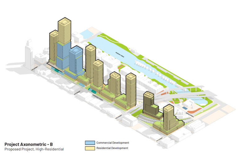
According to Prologis, the firm expects to construct between 7 and 8 million square feet at full build-out, including approximately 4 million square feet of commercial office space and roughly 2,500 dwelling units. The tallest tower would rise at 4th and King Street, with the new Caltrain Station at its base. The first phase of construction is expected to see 2.5 million square feet on the blocks at 4th Street and 7th Street.
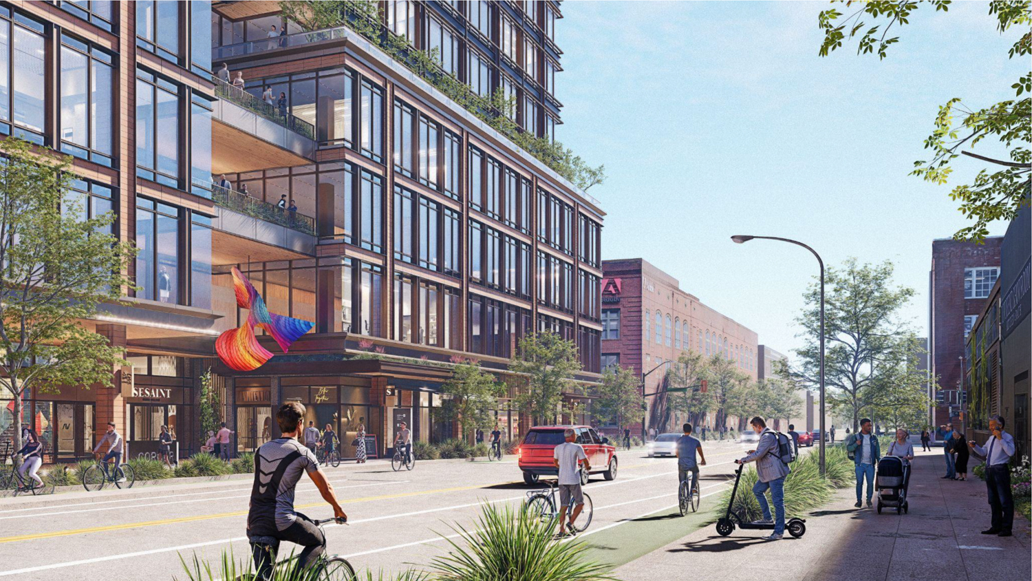
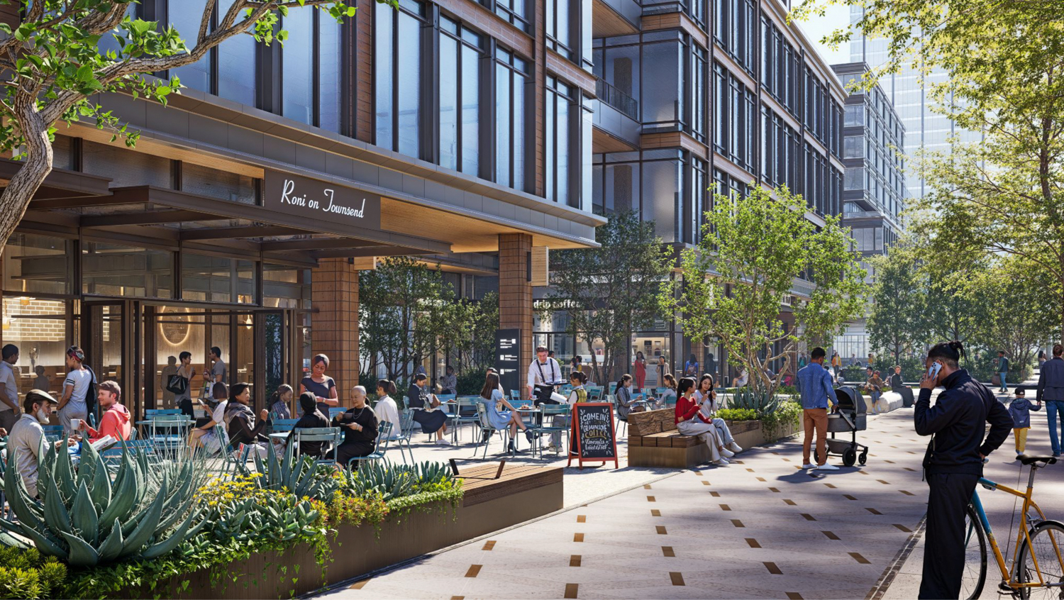
Caltrain San Francisco Railyards pedestrian view at 7th and Townsend, rendering by Prologis
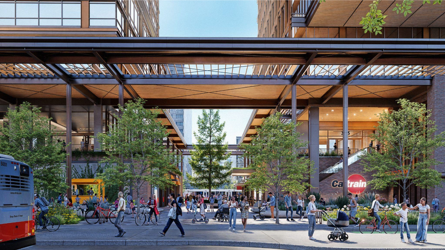
Caltrain San Francisco Railyards internal view, rendering by Prologis
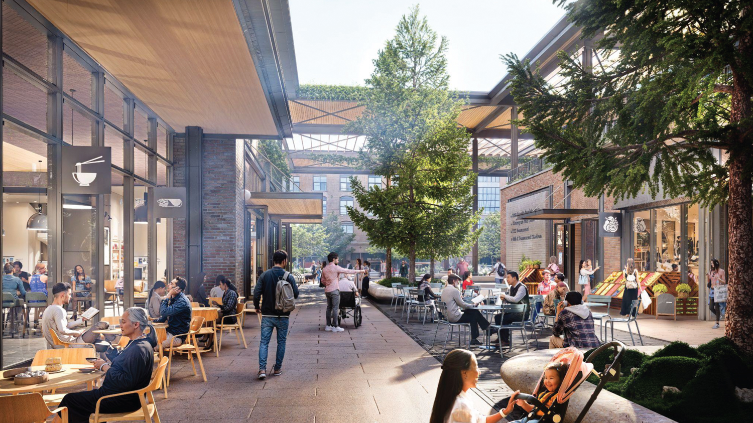
Caltrain San Francisco Railyards view of Station Lane, illustration by Prologis
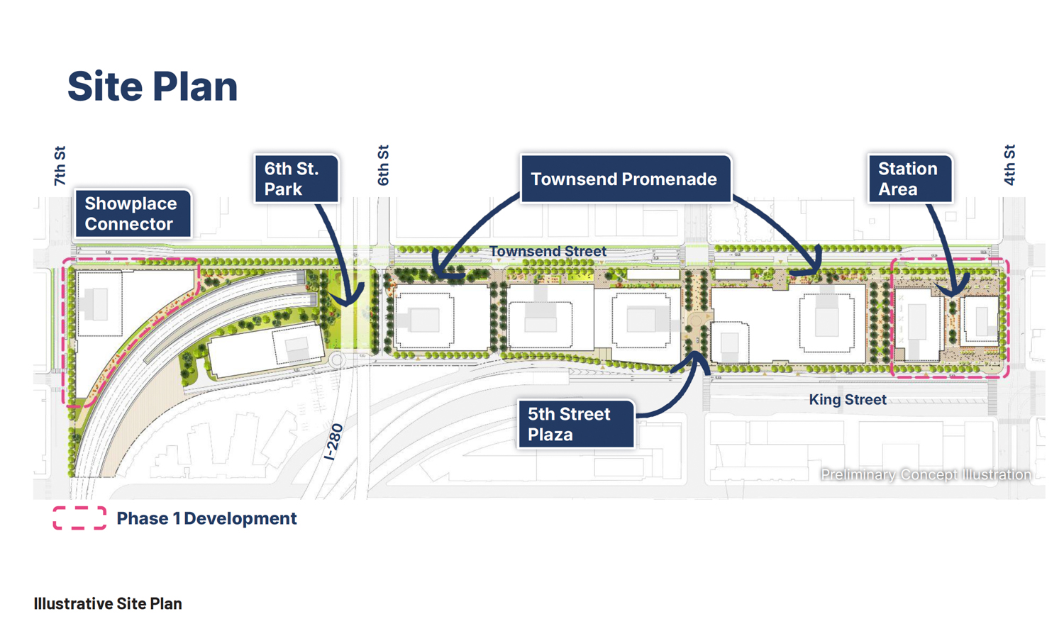
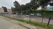
Caltrain San Francisco Railyards proposed site plan, illustration by Prologis
Prologis and Caltrain anticipate funding the project with a combination of private and institutional capital sources for vertical development and public sources for infrastructure and transit-oriented development. The ambitious project aims to construct a world-class destination transit below a high-density mixed-use development and over four acres of public open space spread across a grand urban promenade and parks.
Vice President for Prologis, Genevieve Cadwalader, shared in a press release, “We have engaged extensively with community organizations and neighbors to help shape the project we are advancing today- and that engagement will continue throughout the entitlement process.”
Caltrain San Francisco Railyards sidewalk view of the new Train Station, rendering by Prologis
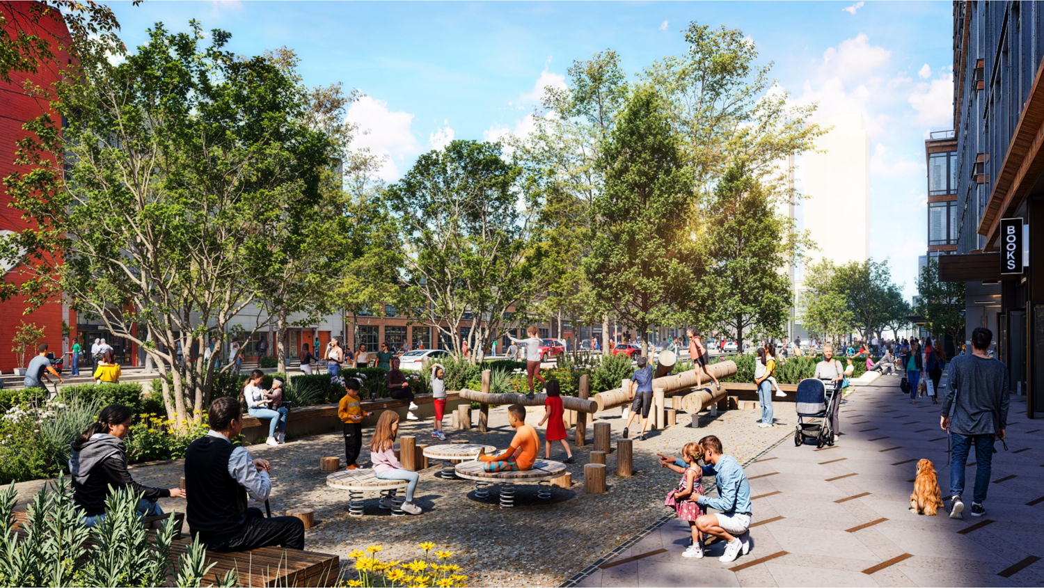
Caltrain San Francisco Railyards sidewalk view of a playground, rendering by Prologis
Michelle Bouchard, Executive Director of Caltrain, added that “Caltrain and our fellow transit agencies are navigating real near-term financial challenges — but this project points toward a different future. This visionary, multi-phased project is a bold bet on San Francisco and on the long-term value of connecting people, housing, and jobs through great transit.”
Anne Taupier, Executive Director of San Francisco’s Office of Economic and Workforce Development, said of the proposal, “this is exactly the kind of development San Francisco needs—one that helps knit together multiple neighborhoods with enhanced public access and new gathering places, brings housing and a high density mix of uses to a transit-oriented site, and helps deliver essential infrastructure improvements both for our regional rail system and the South of Market streetscape. Prologis and Caltrain have worked in close coordination with the City and neighborhood stakeholders in developing this vision, and we look forward to a continued partnership refining this one-of-a-kind project.”
The application writes that the “Proposed Project would modernize the Caltrain Station and Railyard, in coordination with the Transbay Joint Powers Authority’s construction of the Portal Project and the Pennsylvania Avenue extension.” The Portal is the proposed extension of Caltrain to the underground platform station below the Salesforce Transit Center, next to the Salesforce Tower.
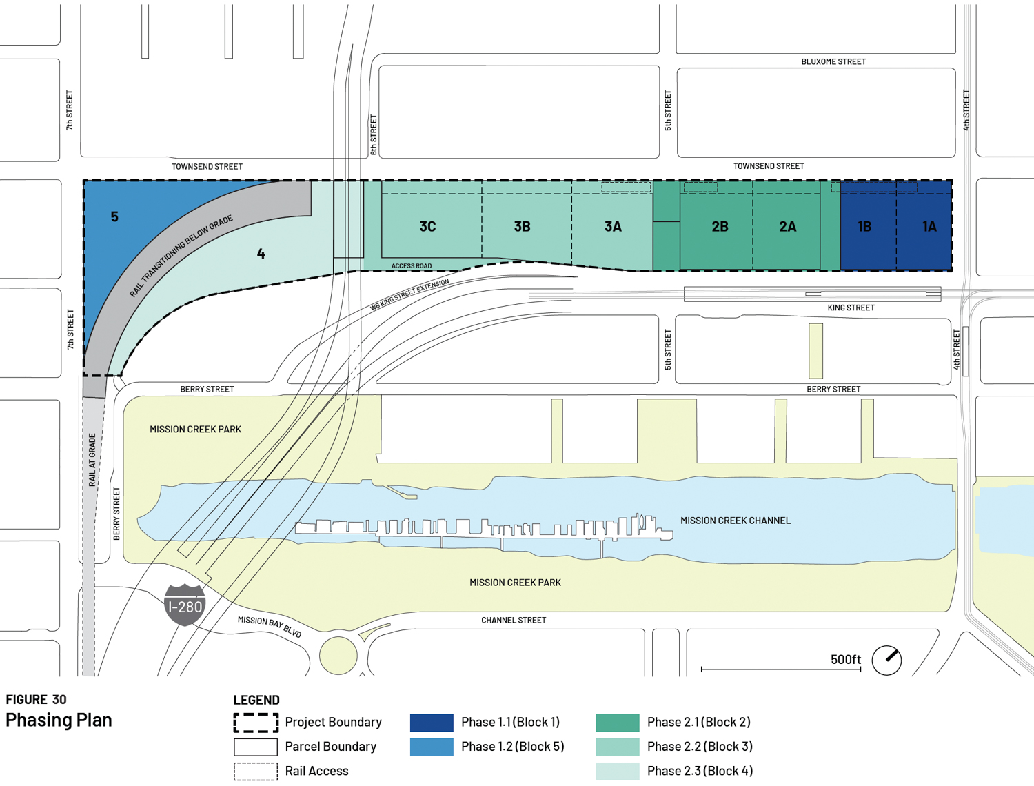
Caltrain San Francisco Railyards estimated construction phase map, illustration by Prologis
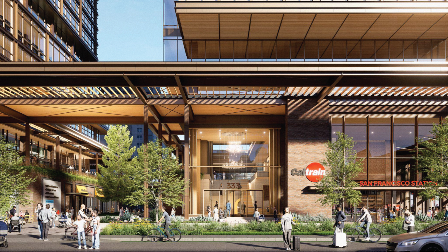
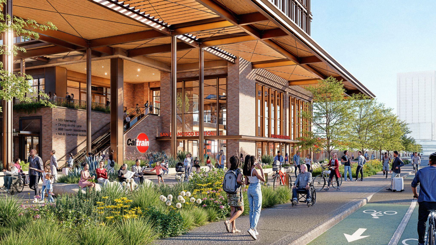
Caltrain San Francisco Railyards front view of the new station entrance, rendering by Prologis
Caltrain San Francisco Railyards proposed retail-lined Townsend Promenade, rendering by Prologis
The Caltrain redevelopment is expected to start with phase one, which includes moving the existing railyard platform and tracks “away from 4th Street to the southwestern border of Block 1, to create space for the initial vertical development on Block 1,” according to the project description. Once the new temporary train station is finished, further construction will require the completion of The Portal and an off-site train storage and maintenance facility. Throughout the construction process, Prologis and Caltrain are expected to maintain the existing rail traffic volume.
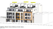
The preliminary application is intentionally vague, providing insight into the general scale of potential redevelopment at the start of the planning process for the city’s planning department and for the public. The first two variants are descriptively labeled the “Maximum Commercial Scenario” and the “Maximum Residential Scenario.” For both scenarios, the general height and structure count are similar. Most new buildings are expected to rise between 350 and 600 feet, with the tallest at 850 feet. Given the information provided by Prologis, the developers will pursue a more evenly mixed variant than the scenarios described in the application.
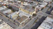
The project will involve four parcels spanning 18.63 acres bound by Townsend Street, 4th Street, King Street, and 7th Street. The site has been part of the city’s railway infrastructure since the late 19th century, with the Southern Pacific Railroad building the initial rail terminal and freight storage facility on Townsend Street between 3rd and 4th Streets in 1873. By 1914, the first temporary passenger station was built in preparation for the Panama-Pacific International Exposition. By 1975, the old depot was replaced by another temporary station, which still exists today.
Caltrain San Francisco Railyards high-commercial variant, illustration by Prologis
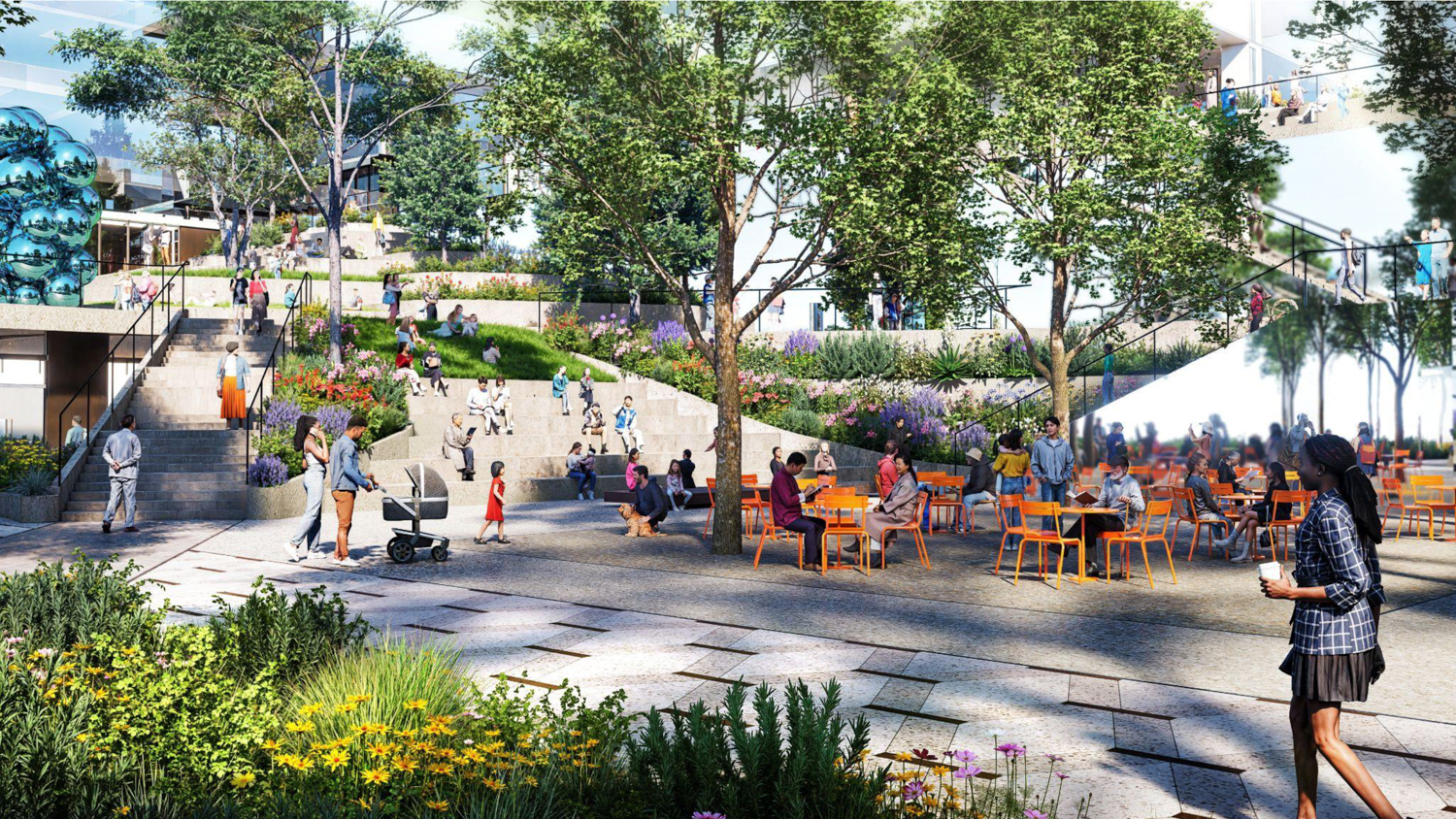
Caltrain San Francisco Railyards view of the 5th Street Park, illustration by Prologis
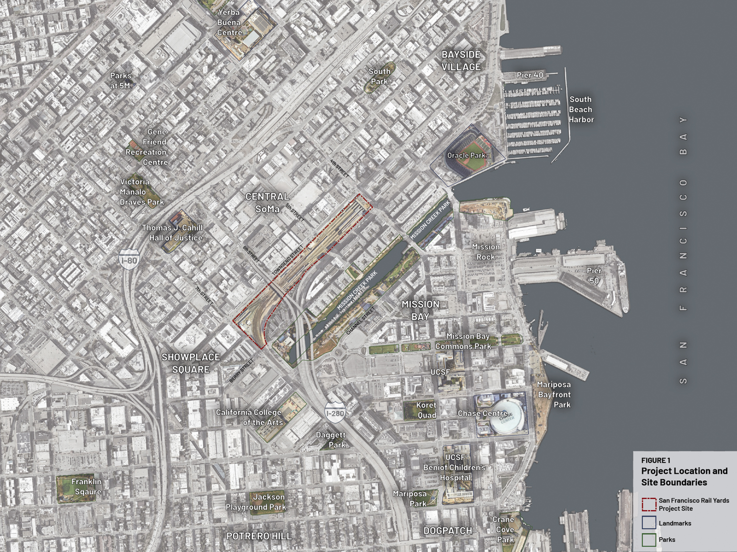
Caltrain San Francisco Railyards site area context, illustration by Prologis
Prologis is a real estate investment trust headquartered at Pier 1 in San Francisco. The firm is best recognized for its international footprint and expansive logistics facilities.
The team expects the phased construction to last 15 to 20 years, with a groundbreaking date yet to be set. Documents estimate that if construction can start by 2029, full build-out might occur as early as 2041 or 2042.
Subscribe to YIMBY’s daily e-mail
Follow YIMBYgram for real-time photo updates
Like YIMBY on Facebook
Follow YIMBY’s Twitter for the latest in YIMBYnews
My goodness they need to expedite every inch of this plan.
This finally answers my biggest question of this being an actual cap or sinking the tracks. It’ll be weird not seeing the sun when getting off the train, but at least they’re all electric now. The diesel would’ve been a b*tch to mitigate fumes. Do the breaking systems with the horrific screech mean there’s lots of break pad particles spewn about each stop?
Connecting the cross streets and added pedestrian plazas will do this area wonders. No longer will all the surrounding streets be this awkward dead zone that just accumulates shady behavior. It’s always a shame seeing King Street just trashed and Townsend covered in glass.
This timeline, though? F*ck why can’t we have anything nice… If the mayor wants to see a city rejuvenation, get that tunnel built.
Drew: Brakes, not breaks.
Thank you for that earth-shattering input. We can now rest soundly on Apple’s inability to keep its autocorrect intact. But glad you managed to understand the premise.
Fugly Yuppie towers, it’s not complicated.
Dude, seriously? Have you nothing better to do than criticize people’s spelling? Consider your priorities in life if the biggest thing in your day is wielding a microscopic amount of power. Give some thought to being supportive of people, giving them some grace or assuming positive intent.
Meanwhile in Oakland we are getting a new Prologis distribution center and ZERO housing along our waterfront by Alameda. Better than the dilapadated Owens factory that Prologis has demo’d, but holy cow we are missing an oportunity to develop our waterfront right now. So jealous of this plan.
This accomplishes nothing.
No, they do NOT need to “expedite every inch of this plan”, as long as said “every inch” includes 4 million square feet of commercial office space. Have you, Drew, not been keeping up with current events?
Last I checked, the amount of vacant office space in San Francisco totaled over 29 million square feet, and it was increasing this year, despite the “AI Boom!” that corporate landlords keep going on about.
You (and S.F.’s developer community) really need to get over this addiction to constructing new office space. Even with this mixed-use proposal, there is simply no need for another 4 million square feet of commercial office space in the present, when this proposal actually breaks ground, or the forseeable or any other future.
It bears repeating that San Francisco already has more than 10 million square of entitled, approved office space on the books that could be built, but their sponsors are waiting for “the market to recover” before they break ground. Adding to that amount of office space in the pipeline is absurd, and the reduction in office space demand resulting from the already underway AI-driven white-collar job destruction is just getting underway.
lol. This project is 40 years from potentially seeing a move-in. I will be shocked if even half the density is built, or if a housing element is swapped. The majority of this should be housing.
You think this fantastic city will allow this massive project block to go unscathed without public input on top of public infrastructure? I am just hopeful we see images of the what-if.
At least your rant isn’t as absurd as that dude saying new housing doesn’t add any value to those living in it. Some people…
For some reason I thought the whole undergrounding thing (the Portal and Pennsylvania Ave) needed to be completed before they did this, but sure, this is great.
The other big thing this area needs is to demolish 280 above the Mariposa intersection. It’s an underused and awful freeway with pylons directly in Mission Creek. Have everyone get on/off at Mariposa (nice feeder into UCSF and Chase Center) and then convert 7th St into a four lane boulevard a la Octavia. The entire area will thrive, centered around Mission Creek as the public park.
would love to see this, but wouldn’t it make more sense for 6th St to become the boulevard?
6th St runs into Mission Creek, so no. It would be 7th.
The 6th St onramp would be demolished and the street would return to the normal grid. They could probably make a nice park on some of that former onramp land.
7th and Townsend could be a bit of a hot mess, but it will be fine. Demolishing the freeway would connect the Design District with Mission Bay more seamlessly, remove a horrible eyesore, and allow Mission Creek to thrive. The northern half of King St would be unnecessary (since it’s a freeway onramp) and could be taken over as more land for the residential / office project. Demolishing the freeway of course opens up more land for parks, housing or office.
City planners and Ed Lee have already floated the idea. It will happen one day.
I honestly didn’t think about this, but now that you say it it seems so obvious. This weird zombie branch of 280 is always destined to get demolished someday, why not do it as part of this project..
Yep. 280 provides a nice offramp exit to both Dogpatch (@ Cesar Chavez) and Mission Bay (@Mariposa). It’s useful to that point and doesn’t get in the way much since it’s going through an industrial area.
After that it really gets in the way. It divides and pollutes real neighborhoods which are rapidly developing. Just like with Octavia, a street level boulevard as the onramp to the freeway is a much better overall design for the health of the area.
The whole spur should be removed back to the 101 interchange.
It was stupid to install it in the first place. Low traffic volumes and massive pollution, particularly noise pollution since it’s elevated.
We’ll need to demolish it eventually anyway, probably much cheaper to get it done in one go
Eh, I hear you but I think given the costs, and pro-highway people who want to quickly access Dogpatch and Mission Bay, I think it’s fine stopping at Mariposa. If something happens on 101, it’s a safety valve for some amount of traffic. But I wouldn’t complain if they removed the whole thing.
Hey Panhandle Pro,
I was thinking along your lines…
What happened to the complete underground tie-in of the train tunnel exit at Mariposa to the SalesForce Station? Once the train is underground, vehicle traffic can come to the streets and the ugly freeway pylons can all come down.
Keeping my fingers crossed…
I think it’s in feasibility study mode or maybe kick off EIR. Unfortunately, I think it’ll be separate project from this and the HSR connection no matter what.
2500 units is good but seriously I would like to have seen even more units for a project this size. It’s a large enough area they should have closer to 4000 units.
Brooklyn just approved a new tower with about 1,200 units. Easily big enough for 5 towers of that density here.
They’re going to dump billions to make this a reality. Make the investment worthwhile.
Ship it. But make it larger.
support transit-oriented development and investment in public transportation. However, a project of this scale—adding approximately 2,500 residential units and millions of square feet of commercial space—should also realistically account for the transportation needs of residents, workers, families, and people with mobility limitations.
The environmental review should carefully evaluate potential spillover parking impacts on surrounding neighborhoods such as Mission Bay and SoMa, which already experience significant event-related and commuter parking pressure. If adequate structured parking and curb management strategies are not considered, new development may increase competition for limited street parking, including accessible spaces.
I encourage the planning team to evaluate mitigation measures such as structured parking capacity and coordination with SFMTA on residential parking management strategies to ensure the project integrates responsibly with the existing community.
It’s… a tarin station.
Why is this issue ONLY an American one? Currently existing, accessible station platforms, accessible MUNI bus platforms, and accessible MUNI streetcars. Bike lanes on all three sides of this block.
Cut the crap of car brain addiction and build for people, for once. Why waste all this damn money on infrastructure if we never use it to its maximum capacity? That’s why MUNI, Caltrain, and BART are constantly on the verge of financial collapse.
I encourage the community to stop holding this country back and enabling the class wars of today. Car brain is why we bomb countries for oil addiction. Personal selfishness is why our cities are designed around two separate classes. Expecting your personal ride to chariot everywhere is why pedestrians must sprint at intersections and pray a distracted driver isn’t the next bus stop massacre.
MUNI should have coordinated with Caltrrain tunneled Central Subway further south well into Mission Bay, but that level of forward thinking is unheard of in the primitive US. All this future density and the clusterf0ck that is the 4th and King intersection could be avoided by undergrounding both rail lines. SF is a cowtown (globally speaking). So is NY tbh
THIS!! They should at least add 1 more underground station south of Yerba Buena and connect the Caltrain station with Muni, similar to what was done on Market Street where BART and Muni were built together. The Caltrain project in that area is already planned using the same cut and cover method, which means they’ll be opening the entire street to build the tunnels anyway. It’s only 2 blocks of work, they can’t miss this opportunity!!
I’m all in favor of this development as soon as possible, but is there a risk that these fine people will just build Block 1 and then nothing else for 20 years, leaving the Caltrain depot stranded in a temporary shack a couple hundred feet away from Muni lines at 4th and King? We’ll probably be waiting until the next century to get the Portal funded and built.
BUILD IT NOW!
Will there be any affordable housing for seniors?
Given the scale of the proposed development—approximately 2,500 housing units and millions of square feet of commercial space—the environmental review should fully analyze transportation access, parking demand, and accessibility impacts on surrounding neighborhoods such as Mission Bay and SoMa.
While the area was originally planned under transit-oriented assumptions, the neighborhood has evolved significantly with major regional destinations such as Oracle Park and Chase Center and a growing residential population. Many residents, workers, visitors, and families still rely on cars, including older adults and individuals with mobility limitations. Currently, accessible parking and curb availability in parts of the neighborhood are already extremely limited.
Without adequate planning for parking infrastructure, large developments can create substantial spillover parking impacts on nearby residential streets, including impacts to accessible parking availability. The environmental review should evaluate mitigation measures such as structured parking facilities for residents and coordination with SFMTA to explore residential parking management strategies, including residential parking permits or similar programs, to protect neighborhood access and accessibility.
So, according to this plan Transbay will be train-less for the next ~20 years?
Sounds very exciting.
They could name it The Orange Blossom Special.
San Francisco is the “greatest anti-growth”metropolis in the country. The Power in the City is more concerned with renaming streets and structures; creating strip mall parks; repurposing streets and escalating costs for property owners – which in the long term escalate costs to renters and business leases. If you notice most of what is currently being developed is housing; albeit, more is needed. If commercial development is proposed, the concern that we don’t need any more office space or it blocks my view of the spaces I never cared of before is meritless, as it is not our money being used and jobs along with taxes realized will help City coffers.
BP.