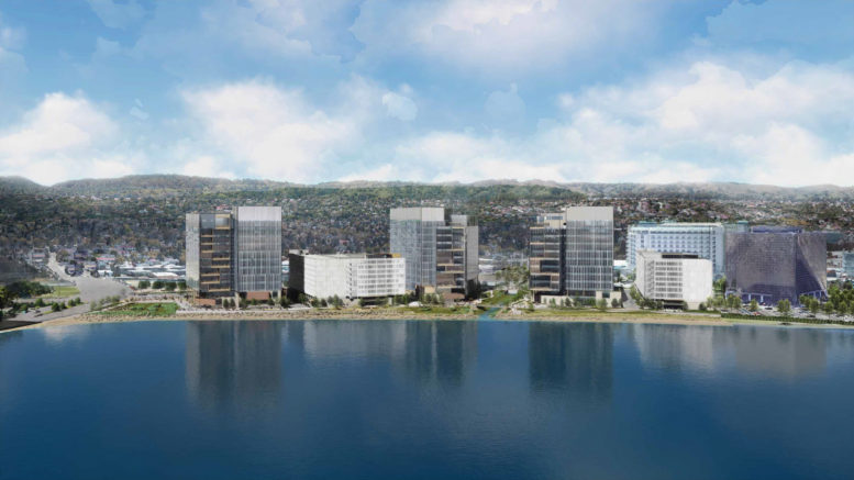
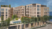
New renderings have been revealed ahead of today’s meeting for Peninsula Crossing, a multi-structure development at 1200-1340 Bayshore Highway in Burlingame, San Mateo County. The city’s Planning Commission will conduct a design review study for the laboratory research complex with two garages and new improvements to the San Francisco Bay Trail. The development is being sponsored by project developer DivcoWest.
Peninsula Crossing Bay Trail and Easton Creek seen from the Shoreline, rendering by WRNS Studio
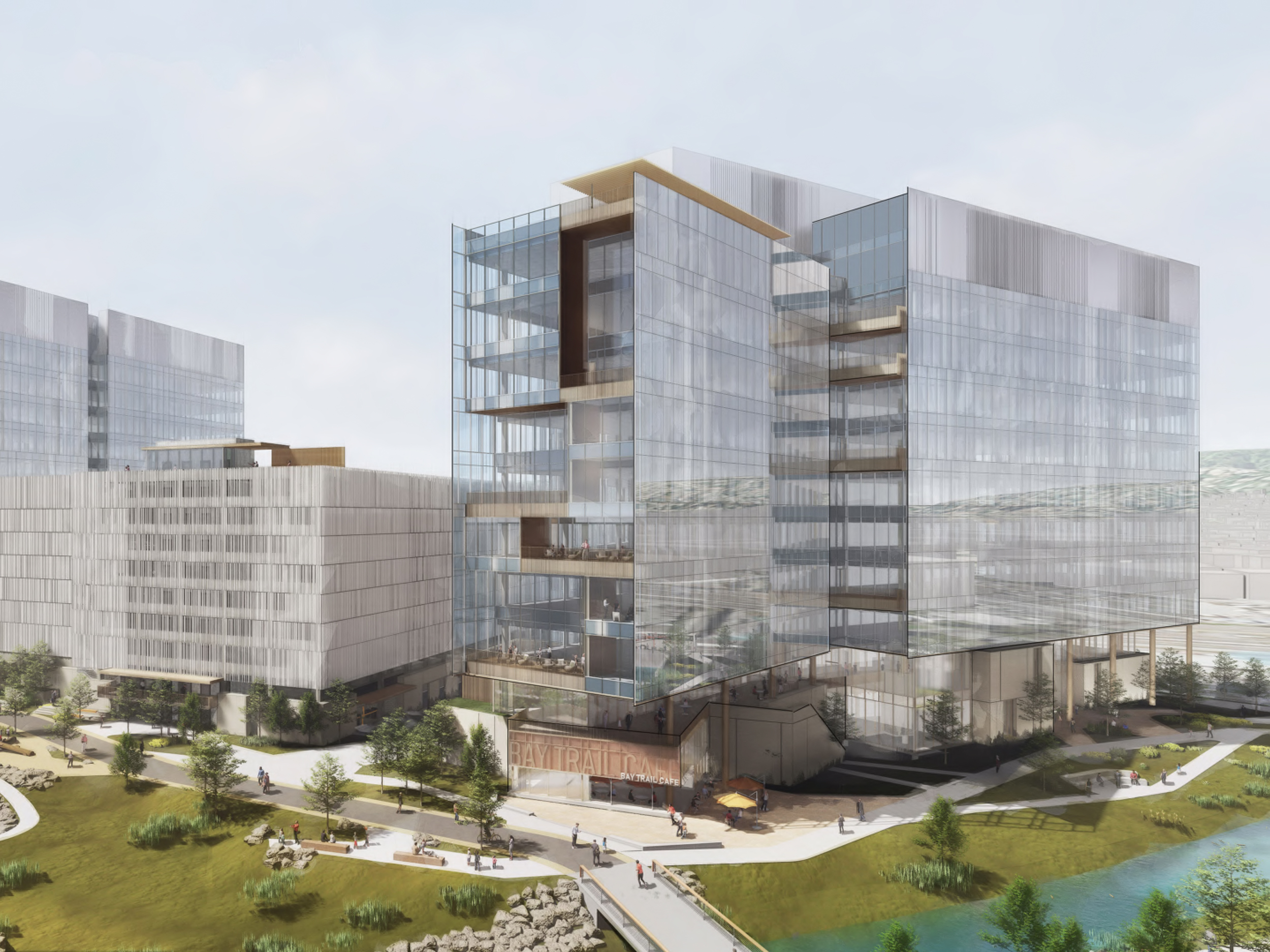
Peninsula Crossing aerial view from Bay Trail looking south, rendering by WRNS Studio
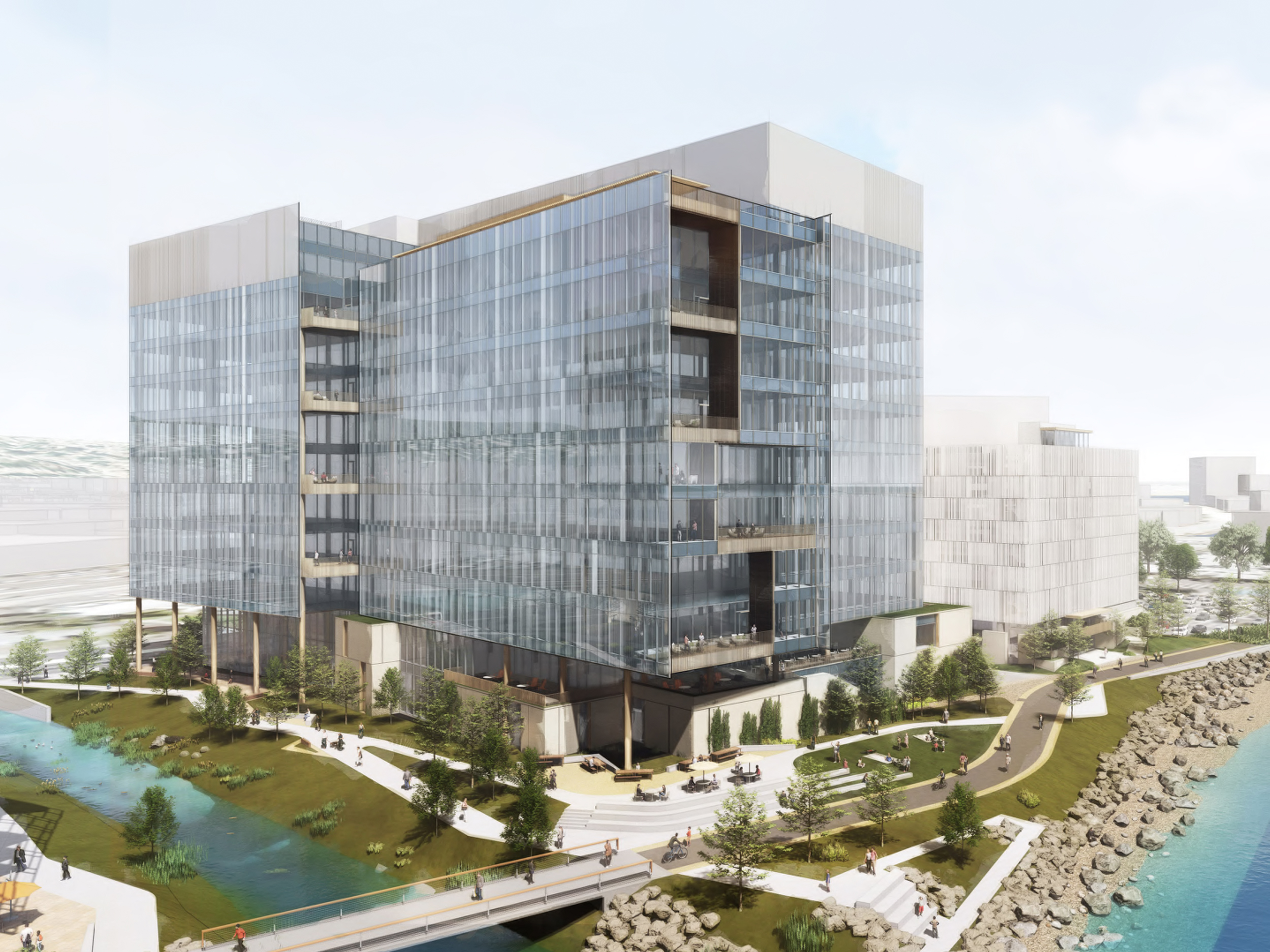
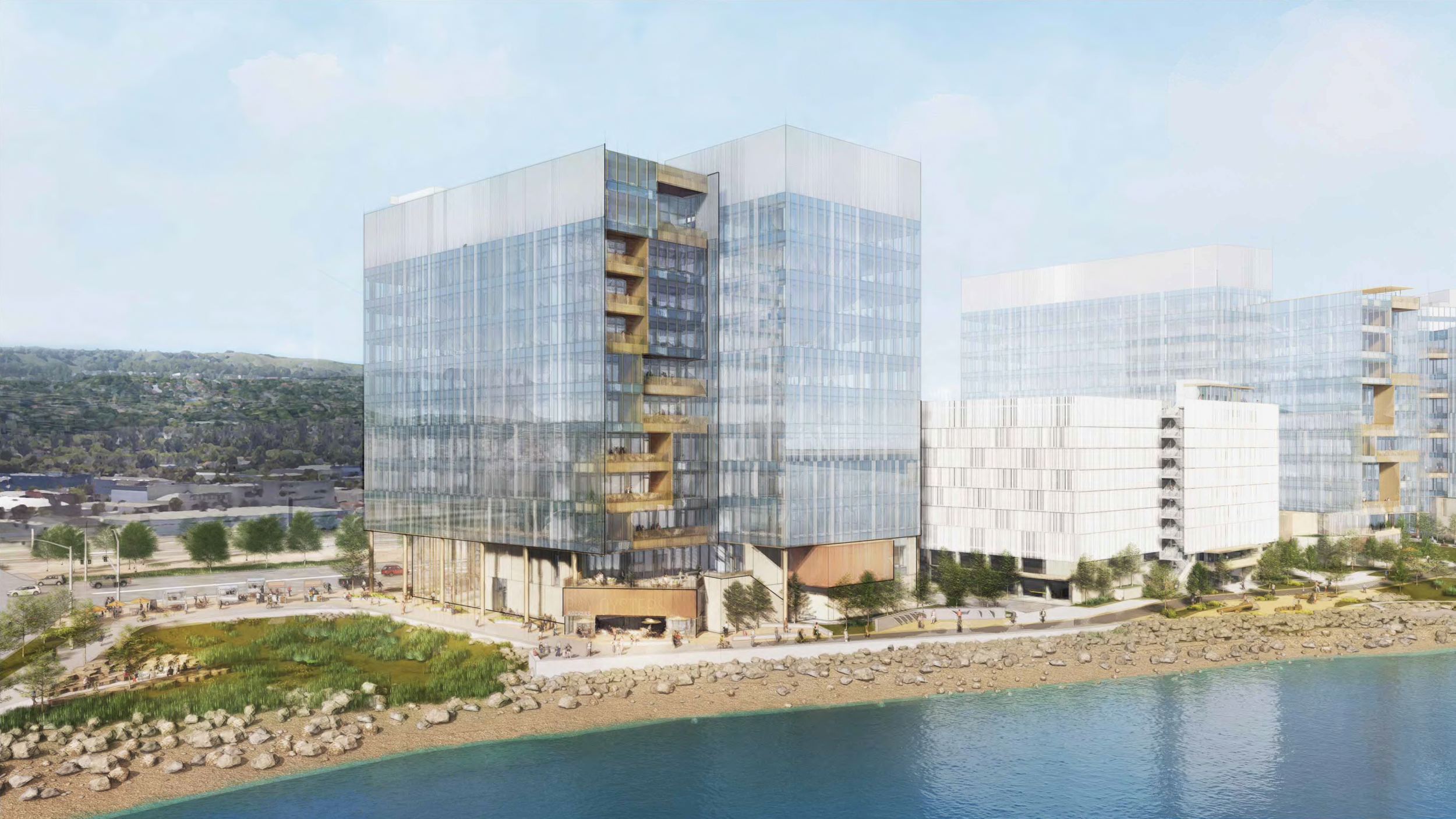
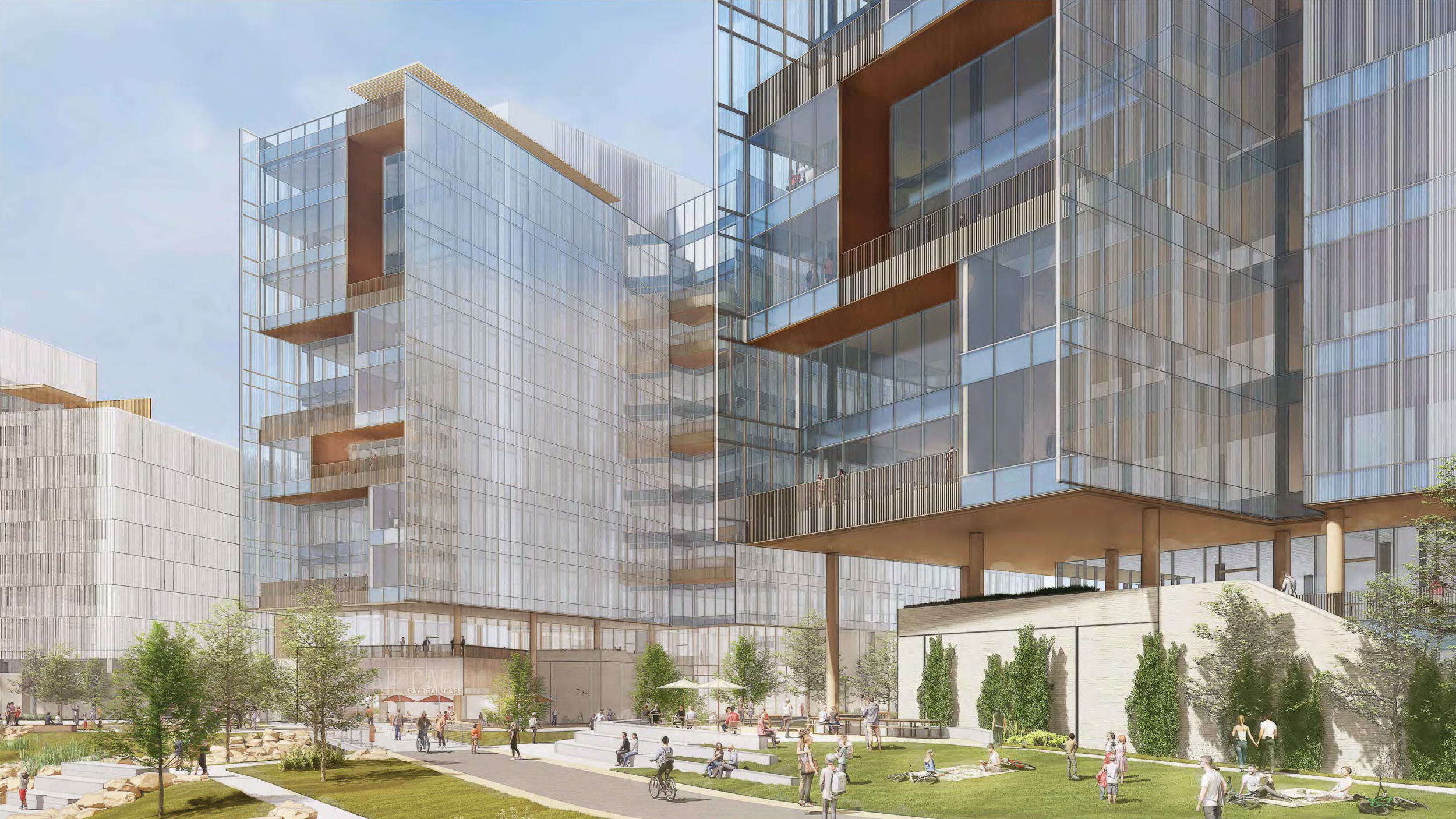
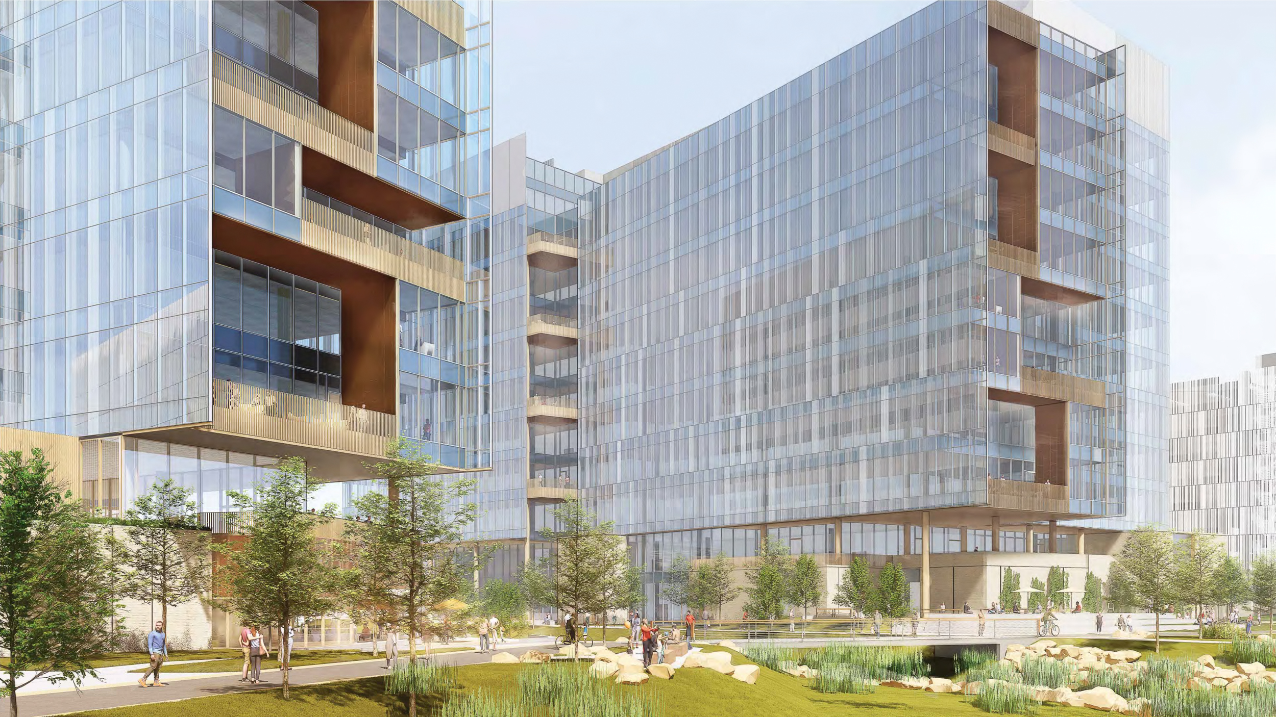
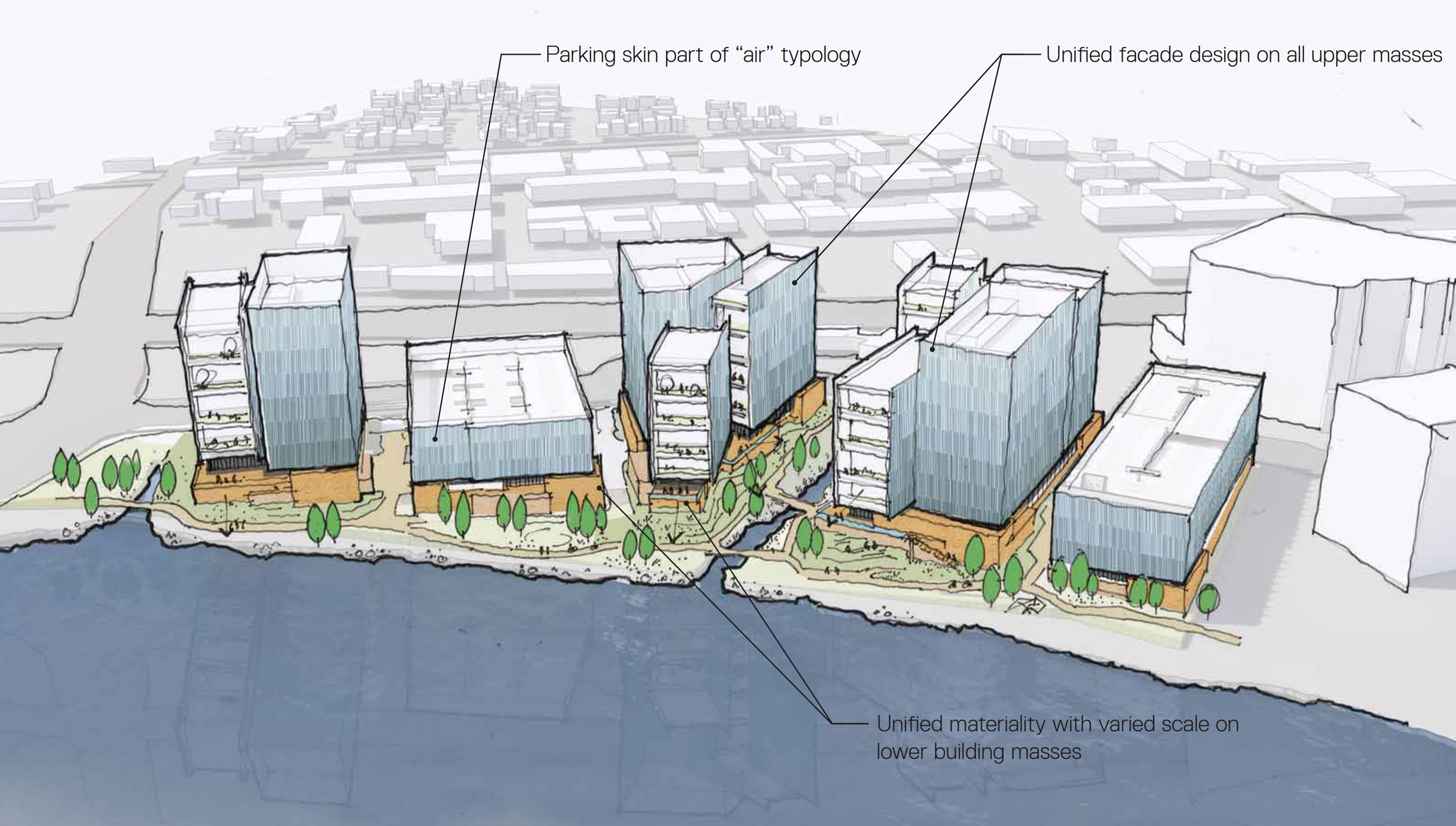
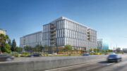
The development will yield around 2.6 million square feet across all five structures, with 1.4 million square feet of rentable area, 5,000 square feet for two restaurants in the South and Central Building, and 1.18 million square feet for parking. The three 11-story office buildings will rise between 210 to 214 feet tall, offering generous ceiling heights for future tenants. Buildings will cover around 45% of the property, with landscaping improvements to another 45% of the 12-acre property.
The project includes a parking capacity for 3,400 cars between two garage structures. While this is slightly less than initially proposed, it exceeds the city’s minimum parking requirement by 550 cars. Additional parking will be included for just 629 bicycles. One parking garage will be located between Building Central and Building South, with the other garage on the northernmost edge of the property.
Peninsula Crossing Building North, rendering by WRNS Studio
Peninsula Crossing Building Central, rendering by WRNS Studio
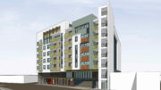
Peninsula Crossing Building South, rendering by WRNS Studio
WRNS Studio is the project architect. Facade materials will include clear glass, fritted glass, perforated metal, concrete, and cementitious panels, graphic interlayered glass, and warm metal panels. The bird-safe facade design will protect local birds by having glass not exceed 15% reflectivity, fritted facade, and no vegetation behind the glass.
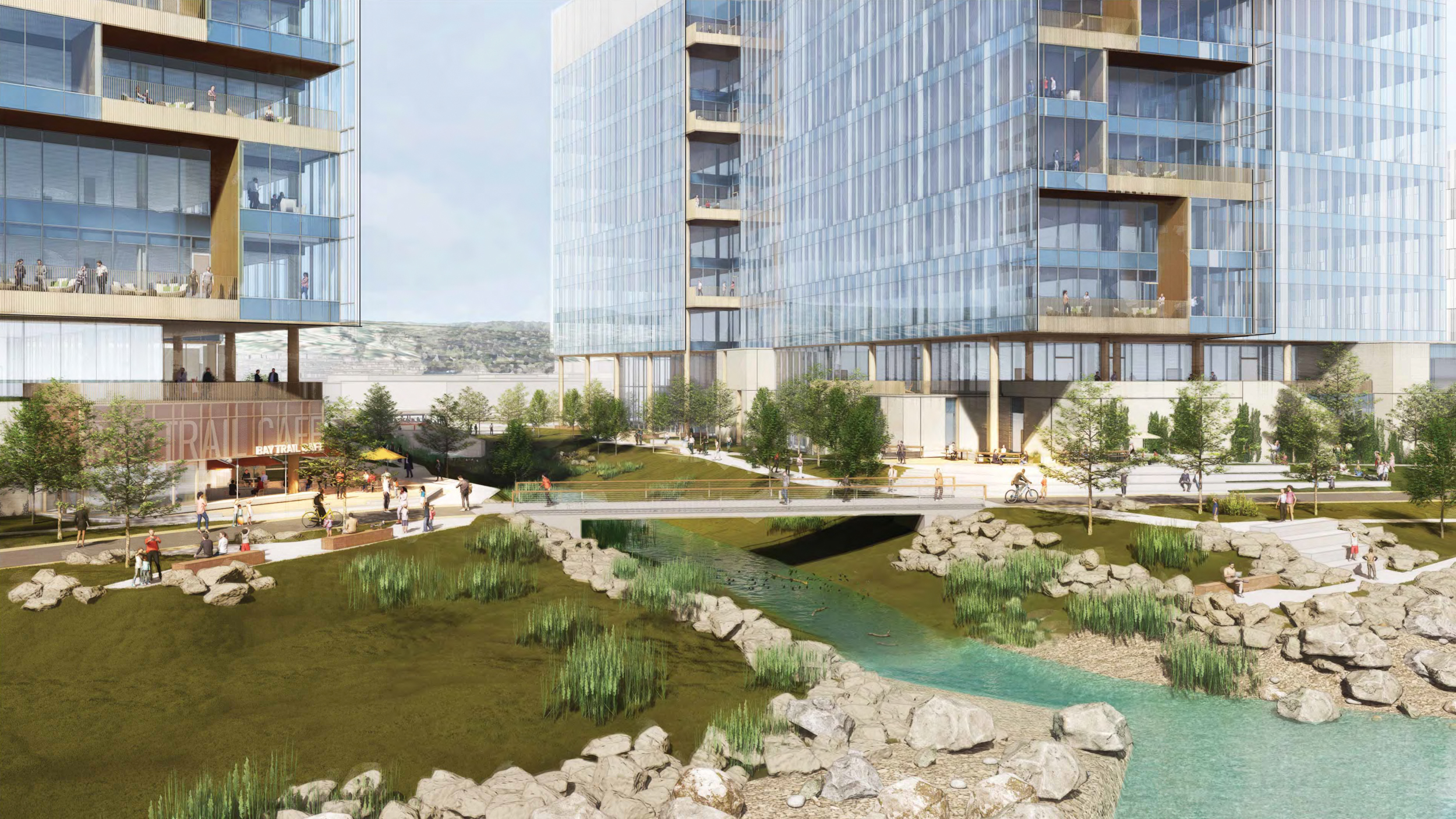
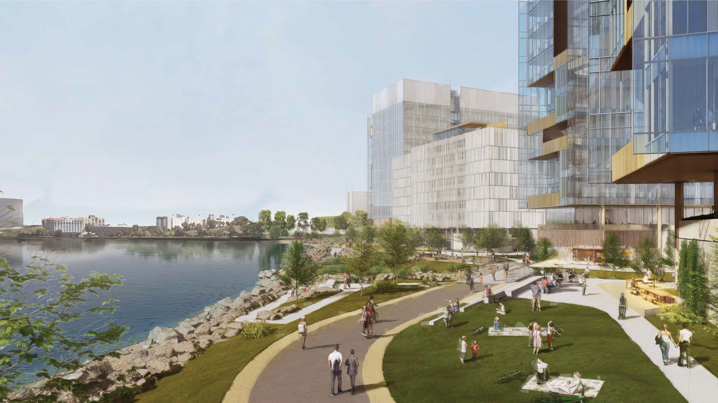
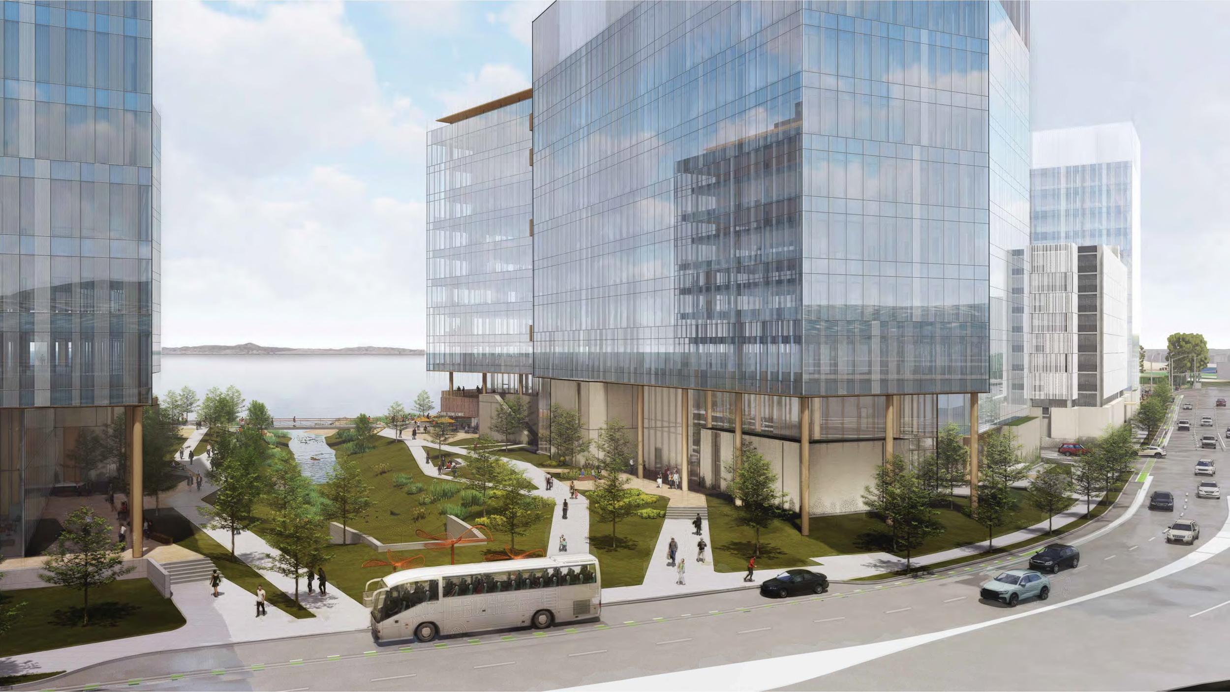
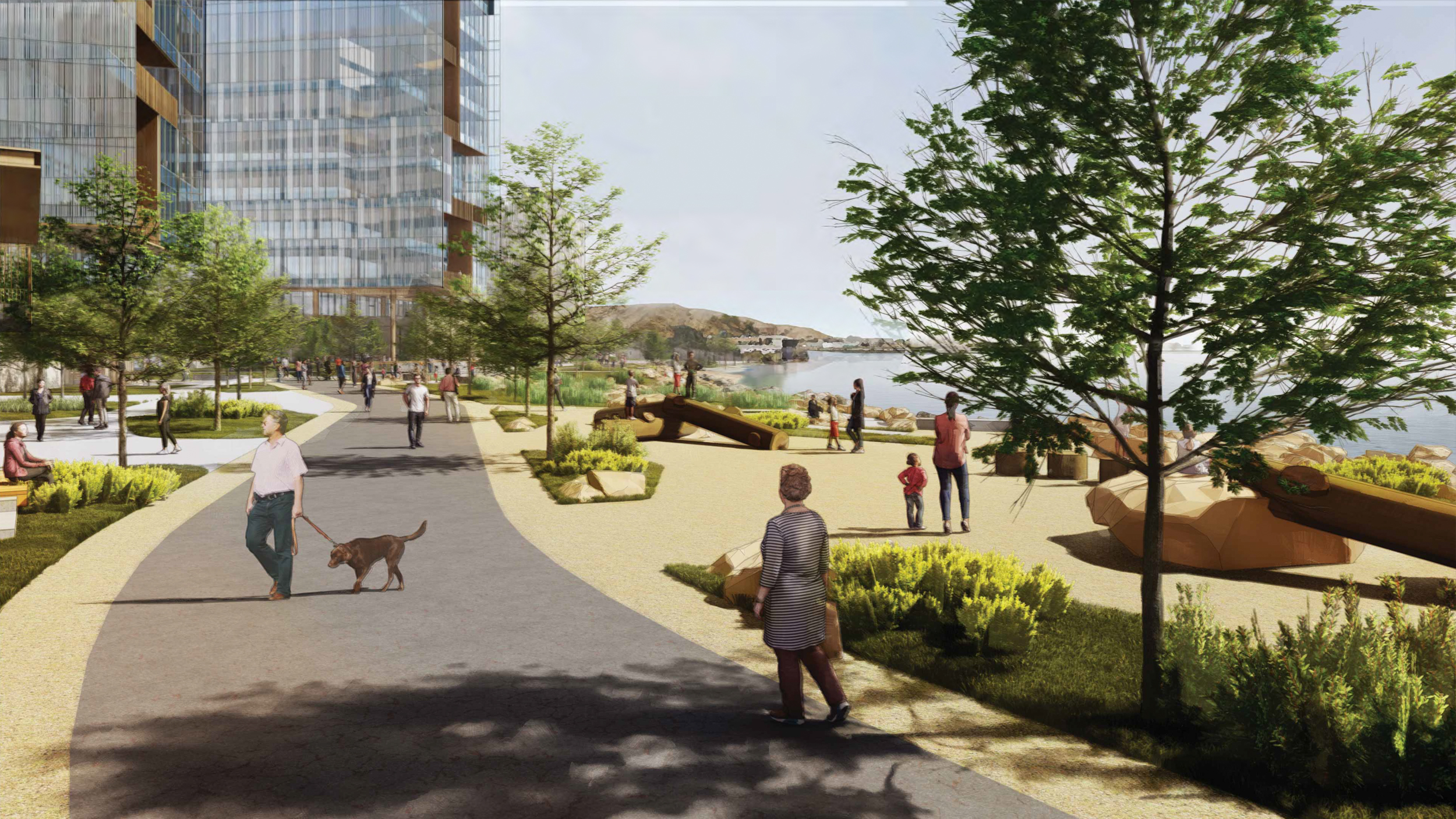
CMG is responsible for landscape architecture. The project’s most high-profile landscaping addition to the city will be 1,475 feet of new landscaping for the regional Bay Trail. The project site will include new connections from the trail to Old Bayshore Highway, bus stops, and the adjacent Hyatt Regency SFO airport.
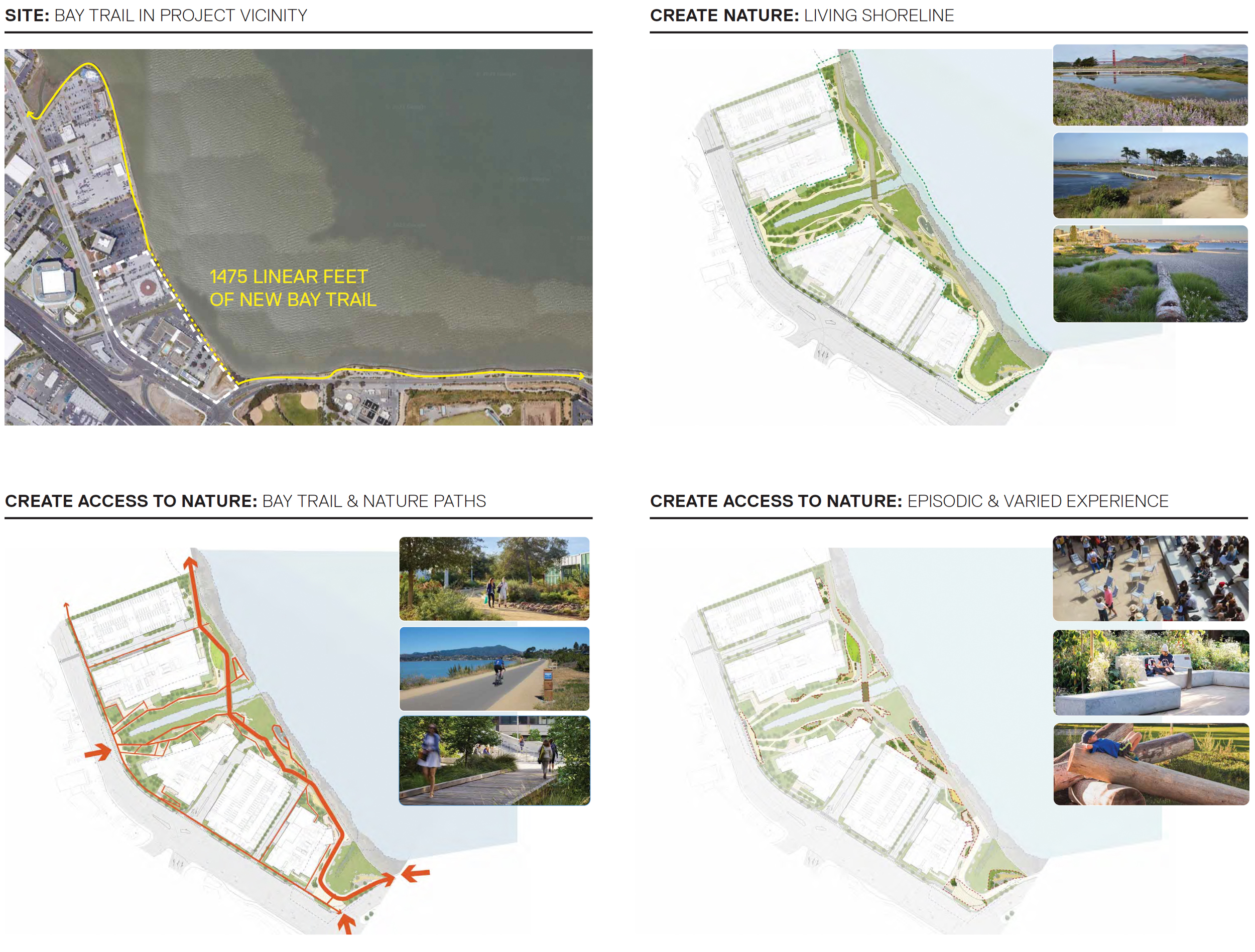
Peninsula Crossing landscaping maps, illustration by CMG
Peninsula Crossing looking east towards Easton Creek, rendering by WRNS Studio
Peninsula Crossing looking southwest to Building Center and Parking South from Building North, rendering by WRNS Studio
Peninsula Crossing Bay trail looking north toward the Easton Creek, rendering by WRNS Studio
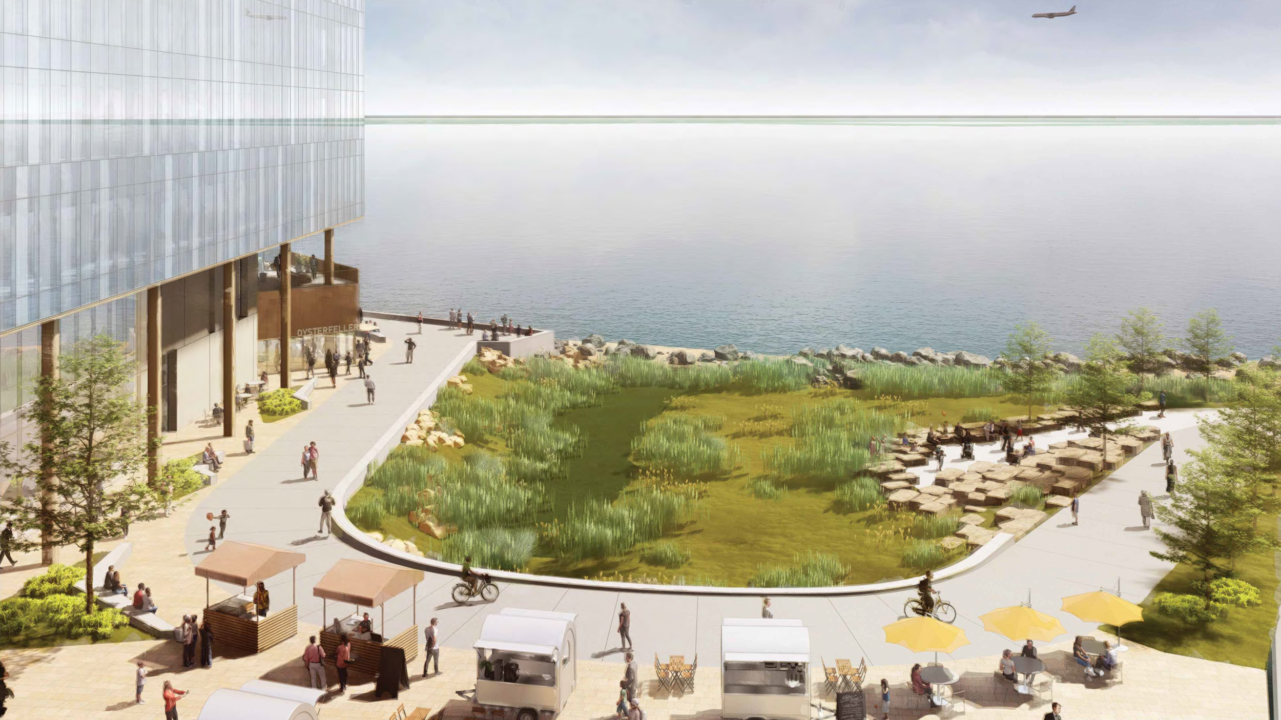
The coastline and land will be improved with native plant life to support the local ecosystem. Pedestrians will find access across paved and unpaved paths to the various experiences across the property. New public amenities will include fitness stations, a discovery play area, boardwalks, and an amphitheater space by Easton Creek. Along with the public park area and plazas, the plans open up a new amphitheater, an event lawn, several art pieces, and an airplane viewing platform.
BKF is the civil engineer, PAE Consulting Engineers is the MEP engineer firm, and IMEG Corp is the project’s structural engineer. The project expects to achieve LEED Gold certification, in part by using all-electric heating and cooling. The whole site will include sea level rise infrastructure, habitat restoration initiatives for wetlands and Easton Creek, off-site improvements for the area’s protected bike lanes, resurfaced roads, and a redesigned 101 off-ramp.
Peninsula Crossing view from the Shoreline Looking North towards Building North, rendering by WRNS Studio
Peninsula Crossing South Gateway Plaza, rendering by WRNS Studio
Peninsula Crossing design concept, rendering by WRNS Studio
Demolition will be required for all existing structures on-site. The presumed first phase of construction will include the Center Building, South Parking Garage, and landscaping for the immediate area. South Building will be finished in phase two, and the final two structures in the third phase. Full Bay trail access will open to the public after phase one is complete, using permanent and temporary bay trail segments.
DivcoWest purchased the properties in two batches, the second of which occurred last year. The firm paid around $109 million for the 12-acre project. The developer is a San Francisco-based company with projects across the country, including Austin, Boston, Los Angeles, New York, Raleigh, Seattle, and Washington, DC. The developer has written on their website that Peninsula Crossing will “revitalize an important part of the Bay’s shoreline creating opportunity for growing life science and technology companies in one of the strongest real estate markets in the country while creating a place for the whole community to enjoy.”
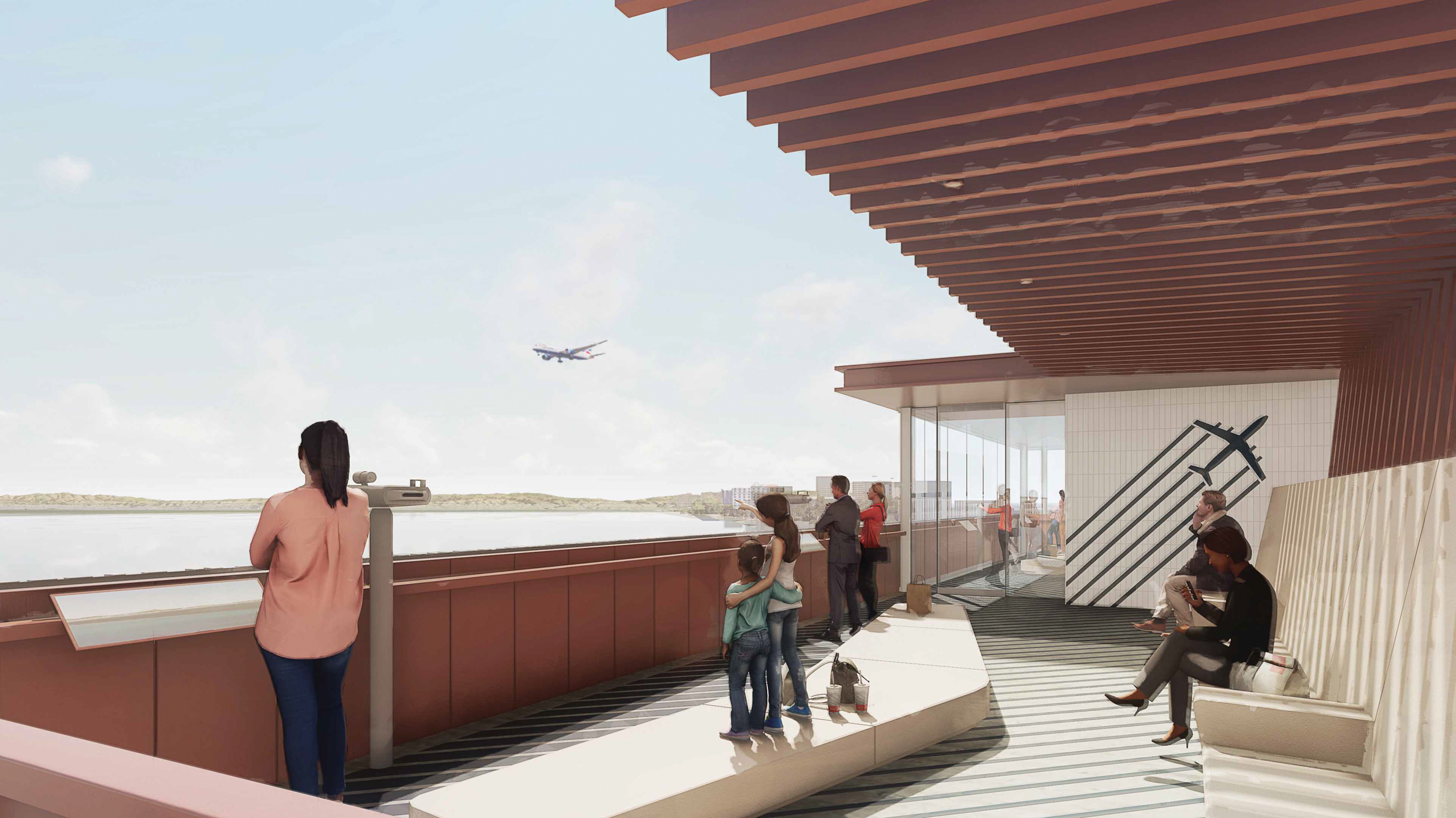
Peninsula Crossing airplane viewing platform from the top of South Parking, rendering by WRNS Studio
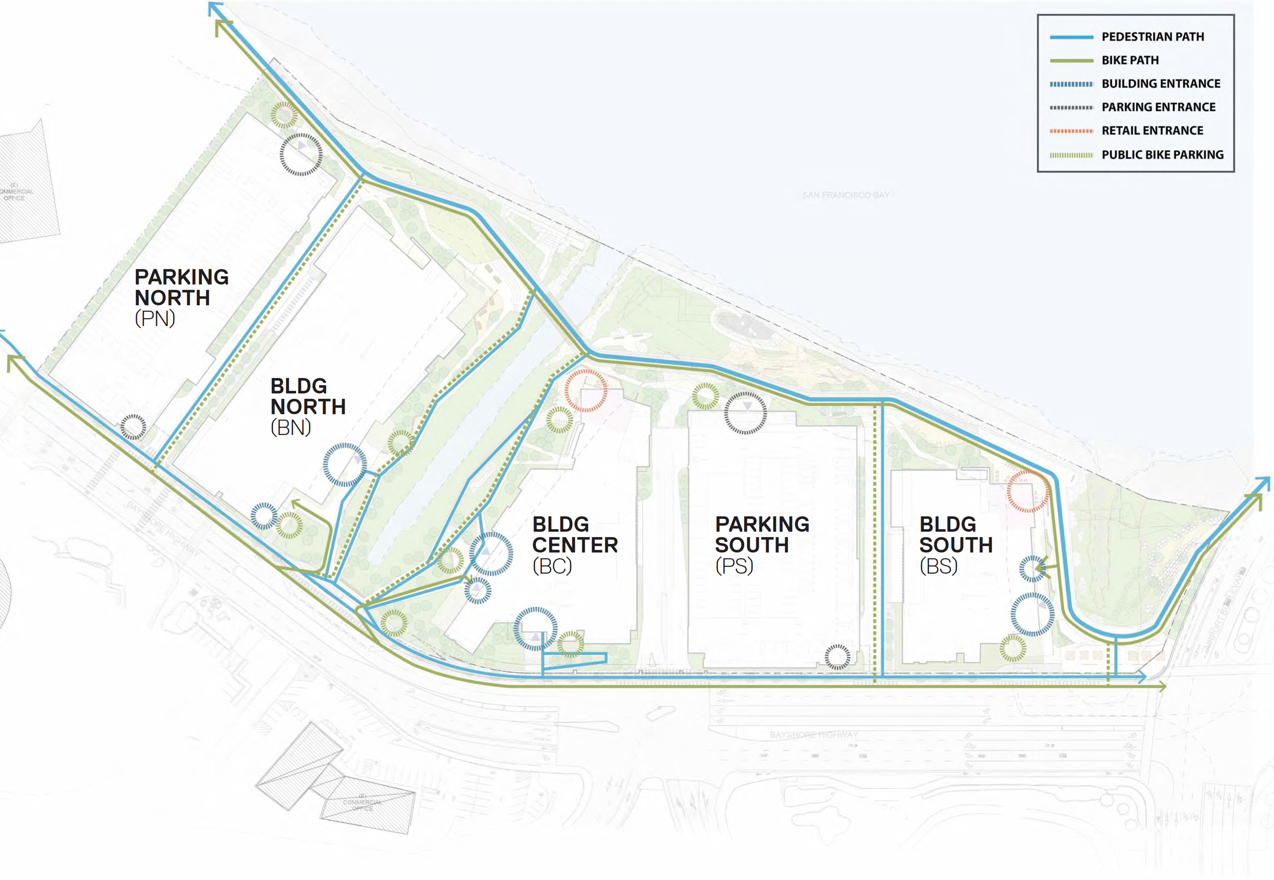
Peninsula Crossing site map, illustration by WRNS Studio
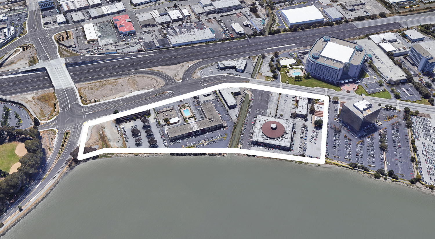
1200-1340 Bayshore Highway, aerial perspective via Google Satellite
The structures will be addressed as 1200, 1250, and 1300 Old Bayshore Highway. The property is currently developed with a few restaurants and a hotel inn. Future employees will find themselves in a mostly industrial and commercial bayside neighborhood just south of SFO and by one of Burlingame’s primary retail thoroughfares, Broadway. The most recent development in the area is Burlingame Point, the four-structure office complex designed by Gensler and now occupied by Facebook.
The Burlingame Planning Commission meeting is scheduled to start today, February 13th, at 7 PM. For more information about how to attend and participate, visit the city website here.
Subscribe to YIMBY’s daily e-mail
Follow YIMBYgram for real-time photo updates
Like YIMBY on Facebook
Follow YIMBY’s Twitter for the latest in YIMBYnews

I wish some of these cities invested in transit-oritented development instead of these massive structures with equally massive parking garages. I’m fine with some parking but the freeways are already more than jammed in that section of 101.
The small cities on The Peninsula are too small to be able to do much with transit, except to upzone their existing CalTrain station locations, or re-route the SamTrans bus service. That only goes so far. Sacramento forcing density on the suburbs? No easy answers.
Well an easy fix is requiring mixed use zoning so people can choose to live by work if they’d prefer to avoid the commute by car. Also, San Mateo county has 765k people and can certainly support 1 or 2 more train lines but the cities don’t have a strong history of public transit interest.
So what you’re suggesting is more government control over where people live and work and what modes of transportation they may use… Like in China or North Korea. Interesting.
Tons of offices in Burlingame but does Burlingame build any housing?
Oakland’s centrally-located, underutilized but transit-rich downtown is ideal for life-science development, even high-rise labs. Will rational regional planning ever converge with market dynamics to enhance workplaces and the environment?